Dajti National Park
| Parku Kombëtar Dajti | ||
|---|---|---|
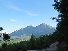
| East side of the Dajti and core area of the park in the evening light | ||
|
|
||
| Location: | Tirana Qark , Albania | |
| Specialty: | Mountain forest | |
| Next city: | Tirana | |
| Surface: | 29,216.9 ha | |
| Founding: | 1966 (extended 2006) | |
| Dajti and the gondola | ||
The Dajti National Park ( Albanian Parku Kombëtar Dajti ) is a national park in central Albania east of the capital Tirana . Today it covers a large part of the mountainous hinterland of Tirana County . Its area is 29,216.9 hectares. Some 200 year old beeches are considered a special attraction.
history
In 2006, the area of the national park was drastically expanded from the 3,300 hectares, which had already been protected since 1966, to include the Dajti and Priska mountains to 29,216.9 hectares. It now encompasses mountainous areas from north of the Bovilla Reservoir to the Erzen Gorge in the south, where several thousand people still live in scattered villages. The specially protected core zone is over 9,000 hectares in size.
In 2018 the new expressway Rruga e Arbërit was under construction, which crosses the park north of the Dajtis from west to east.
fauna and Flora
In addition to the forests and the beautiful mountain landscape with many wild flowers, the protection of numerous mammals also applies : wild boars , wolves , foxes , hares , brown bears and wild cats should live in the park . In the lower part of the mountain the vegetation is determined by macchia with a lot of heather , myrtle and strawberry bushes . Around 1000 meters above sea level there is a zone with oak forest . Beech forest with some conifers follows above . There is almost no vegetation on the rocky top of Dajti.
leisure
The visitor center and most of the leisure activities are located in the core zone on the western slope of Dajti Mountain. There are now numerous restaurants around Fusha e Dajtit , where there used to be a holiday camp. From this small plain you have an excellent view of Tirana and the plain, which is why it is also called the balcony of Tirana .
The Fusha e DAJTIT can be reached via a narrow mountain road. Since June 2005, day trippers can also take a gondola lift from the eastern outskirts of Tirana . This first cable car in Albania for the transport of tourists was built by an Austrian company and, according to its own advertising, is the longest in the Balkans.
The Dajti is well suited for hiking. The summit, however, as a restricted military area, cannot be climbed.
Web links
- Website of the National Agency for protected areas of the national park (English)
- Website of the National Tourism Agency of the National Park (English)
- Dajti and Dajti Ekspres gondola
- Dajti Ekspress website
Individual evidence
- ^ Dajti National Park, Albania. In: Western Balkans Geotourism Mapguide. National Geographic, accessed February 2, 2016 .
- ↑ Vendim No. 402 (June 21, 2006): Për shpalljen e ekosistemit natyror të Malit të Dajtit "Park Kombëtar" (me sipërfaqe të zgjeruar). (PDF) In: Official Journal No. 68 2006. P. 26 ff. , Accessed on December 27, 2015 (Albanian).


