Neponset Reservoir
| Neponset Reservoir | |||||||
|---|---|---|---|---|---|---|---|
| Neponset Reservoir with Gillette Stadium in the background | |||||||
|
|||||||
|
|
|||||||
| Coordinates | 42 ° 5 '5 " N , 71 ° 14' 43" W | ||||||
| Data on the structure | |||||||
| Data on the reservoir | |||||||
| Altitude (at congestion destination ) | 81 m | ||||||
| Water surface | 1.36 km² | ||||||
| Maximum depth | 10 ft (3 m ) (mean depth 4 ft (1 m )) | ||||||
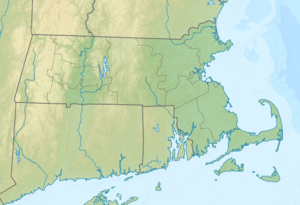
The Neponset Reservoir is a reservoir near the town of Foxborough in Norfolk County in the state of Massachusetts in the United States ( US body code : 612493 ).
It forms the source of the Neponset River and is popular with anglers . However, it was originally created for industrial use.
history
On February 18, 1845, the Neponset Reservoir Company was founded to build and manage a reservoir by building a dam over the Neponset River. The company was founded by five companies whose mills needed water to operate. By damming the river, the water levels could be controlled and the farms could be supplied evenly. To build the dam, Virginian juniper was felled in five swamps , the area around the dam was excavated and the resulting basin was flooded. Today's dam is largely preserved in its original form.
In 2003 the body of water was classified as significantly dangerous as part of an investigation. In response, the Neponset Reservoir Company removed 11 in (279 mm ) from the drain to relieve pressure on the dam. The reconstruction of the dam was completed in summer 2010 and the water level was reset to its historical level.
use
In the 1920s, the reservoir began to be used as a recreational area. In the following 50 years two marinas , a water ski club and a scout camp were built. Currently over 90 acres (364,217 m²) of land in the western part of the reservoir are protected and offer a variety of cycling and hiking trails accessible from the Messinger , Munroe , Chestnut and Payson roads . At the end of Kersey Road is a small park called Kersey Point .
fauna
In the Neponset Reservoir there are a variety of different warm water fish that are regularly fished by anglers . Most recently, the existing fish species were recorded in 1998, whereby the species American eel , black-spotted sunfish , blue sunfish, catfish , chain pike , golden shiner ( Notemigonus crysoleucas ), largemouth bass , common sunfish , red breast sunfish, sea bass and American river bass were identified. Otherwise, a wide variety of wild animals such as swans , ducks , sawaws , geese , herons , cranes , turtles , beavers and muskrats live on and around the lake . There are also reports of eagles and loons sighted .
Water quality
The Neponset Reservoir was contaminated with industrial wastes containing heavy metals and phosphates for over 20 years from the 1960s to 1980s . This was done completely legally and was approved by the US Environmental Protection Agency (EPA) as well as the Massachusetts Department of Environmental Protection .
Web links
- Friends of the Neponset Reservoir. Retrieved January 7, 2012 .
- Official website of the Neponset Reservoir. In: NRRC Neponset Reservoir Foxboro. Retrieved January 7, 2012 .
- Neponset Reservoir in the Geographic Names Information System of the United States Geological Survey
Individual evidence
- ^ Neponset Reservoir Fishing in Norfolk County, Massachusetts. Mansfield Area. In: Fishing Works. Retrieved January 7, 2012 .
- ↑ a b Neponset Reservoir's general history. (No longer available online.) In: Friends of the Neponset Reservoir. Archived from the original on February 27, 2010 ; accessed on January 7, 2012 (English). Info: The archive link was inserted automatically and has not yet been checked. Please check the original and archive link according to the instructions and then remove this notice.
- ^ A b History of the Neponset Reservoir. Retrieved January 7, 2012 .

