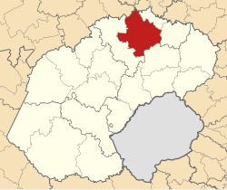
Ngwathe
| Ngwathe Ngwathe Local Municipality |
|
|---|---|
 |
|
| Basic data | |
| Country | South Africa |
| province | free State |
| District | Fezile Dabi |
| Seat | Parys |
| surface | 7055 km² |
| Residents | 120,520 (October 2011) |
| density | 17 inhabitants per km² |
| key | FS203 |
| ISO 3166-2 | ZA-FS |
| Website | www.ngwathe.fs.gov.za (English) |
| politics | |
| mayor | Joey Mochela |
Coordinates: 26 ° 54 ' S , 27 ° 27' E
Ngwathe ( English Ngwathe Local Municipality ) is a local municipality in the district of Fezile Dabi , Free State Province in South Africa . The seat of the municipal administration is in Parys . Joey Mochela is the mayor.
The parish name is the Sesotho word for the Renoster River that flows through the parish.
Cities and towns
population
In 2011 the community had 120,520 inhabitants. Of these, 86.5% were black, 10.3% white and 2.6% colored . The population decreased to 118,907 people by 2016.
The first language was 67.8% Sesotho, 13.2% Afrikaans, 8.4% isiXhosa , 3.4% isiZulu , 1.9% English and 1% Setswana .
Attractions
- Vredefort crater , one of the largest meteorite impact craters on earth.
Web links
- The community site (English)
Individual evidence
- ^ Local Government Handbook. South Africa: Ngwathe Local Municipality (FS203) . on www.localgovernment.co.za (English).
- ^ Department of Arts and Culture: Place Names . at www.salanguages.com (English).
- ↑ 2011 census: Ngwathe . accessed on July 12, 2020.
- ↑ Statistics South Africa : Community Survey 2016 . at www.statssa.gov.za (English), accessed on September 17, 2017.
- ^ Statistics South Africa : Ngwathe . at www.statssa.gov.za (English).