Nonette (river)
| Nonet | ||
|
The river in Borest |
||
| Data | ||
| Water code | FR : H22-0400 | |
| location | France , Hauts-de-France region | |
| River system | His | |
| Drain over | Oise → Seine → English Channel | |
| source | in the municipality of Nanteuil-le-Haudouin 49 ° 8 ′ 15 ″ N , 2 ° 49 ′ 23 ″ E |
|
| Source height | approx. 95 m | |
| muzzle | in the municipality of Gouvieux in the Oise coordinates: 49 ° 12 ′ 12 " N , 2 ° 23 ′ 58" E 49 ° 12 ′ 12 " N , 2 ° 23 ′ 58" E |
|
| Mouth height | approx. 25 m | |
| Height difference | approx. 70 m | |
| Bottom slope | approx. 1.8 ‰ | |
| length | approx. 40 km | |
| Left tributaries | Whimsy | |
| Right tributaries | Aunette | |
| Small towns | Senlis , Chantilly | |
|
The river endows the water bodies in the park of Chantilly Castle |
||
The Nonette is a river in France that runs in the Oise department in the Hauts-de-France region . It rises on the eastern outskirts of Nanteuil-le-Haudouin , generally drains in a west-northwest direction through the Oise-Pays de France Regional Nature Park and flows into the Oise as a left tributary after around 40 kilometers in the municipality of Gouvieux .
Places on the river
(Order in flow direction)
- Nanteuil-le-Haudouin
- Versigny
- baron
- Fontaine-Chaalis
- Borest
- Mont-l'Évêque
- Senlis
- Courteuil
- Avilly-Saint-Léonard
- Vineuil-Saint-Firmin
- Chantilly
- Gouvieux
- Toutevoie , municipality of Gouvieux
ecology
The main areas of the Natura 2000 bird sanctuary, Massif des Trois Forêts et Bois du Roi, extend along the southern bank of the river .
Attractions
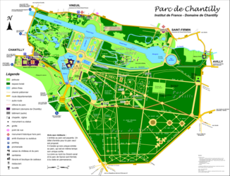
- Chantilly Castle, 16th century castle with a large park - Monument historique . The nonette was canalized for crossing the park and endowed all water areas in the park.
Web links
Commons : Nonette - collection of images, videos, and audio files
Commons : Chantilly Castle Park - Collection of images, videos and audio files
Individual evidence
- ↑ Source height according to geoportail.gouv.fr
- ↑ mouth height according to geoportail.gouv.fr
- ↑ Nonette in SANDRE (French)
- ^ Massif des Trois Forêts et Bois du Roi
- ↑ Chantilly Castle in the Base Mérimée of the French Ministry of Culture (French)

