North Maalhosmadulu Atoll
| North Maalhosmadulu Atoll | ||
|---|---|---|
| NASA satellite image of North Maalhosmadulu Atoll | ||
| Waters |
Lakkadive Sea (Indian Ocean) |
|
| archipelago | Maldives | |
| Geographical location | 5 ° 36 ′ N , 72 ° 56 ′ E | |
|
|
||
| Number of islands | 86 | |
| Main island | Ungoofaaru | |
| length | 65 km | |
| width | 28 km | |
| Land area | ||
| Residents | 17,000 (2006) | |
| Map of the Raa district | ||
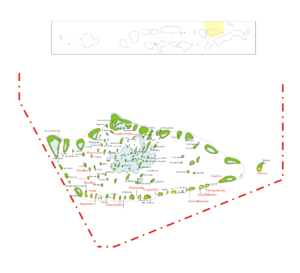
The North Maalhosmadulu Atoll is located in the western island chain of the Maldives in the Lakkadive Sea .
geography
The atoll is 65 kilometers long and up to 28 kilometers wide and is separated from the Alifushi Atoll by an approximately five kilometers wide channel in the north and the Fasdhūtherē Atoll by the four kilometers wide Moresby Channel in the south .
Of the total of 86 islands in the atoll, 13 further islands are inhabited in addition to the main island Ungoofaaru . The atoll airfield is located on the island of Ifuru .
Island table
![]() Map with all coordinates: OSM | WikiMap
Map with all coordinates: OSM | WikiMap
The following list shows all the inhabited islands (as well as the uninhabited airport island Ifuru) of the North Maalhosmadulu Atoll.
| Island name | Alias | Coordinates | surface | Residents 2014 | annotation |
|---|---|---|---|---|---|
| Vaadhoo | 05 ° 51 ' N , 072 ° 59' E | ... | 375 | ||
| Rasgetheemu | 05 ° 48 ' N , 073 ° 00' E | ... | 487 | ||
| Angolhitheemu | 05 ° 48 ' N , 073 ° 00' E | ... | 373 | ||
| Hulhudhuffaaru | 05 ° 46 ′ N , 073 ° 01 ′ E | ... | 1.103 | ||
| Ifuru | 05 ° 42 ′ N , 073 ° 01 ′ E | ... | - | Airfield | |
| Ungoofaaru | 05 ° 40 ′ N , 073 ° 02 ′ E | ... | 1,388 | Main island | |
| Dhuvaafaru | 05 ° 38 ' N , 073 ° 03' E | ... | 2,924 | ||
| Maakurathu | 05 ° 36 ' N , 073 ° 03' E | ... | 769 | ||
| Rasmaadhoo | 05 ° 34 ' N , 073 ° 03' E | ... | 496 | ||
| Innamaadhoo | 05 ° 33 ' N , 073 ° 03' E | ... | 504 | ||
| Maduvvaree | Maduvvari | 05 ° 29 ' N , 072 ° 54' E | ... | 1,398 | |
| Inguraidhoo | 05 ° 29 ′ N , 073 ° 02 ′ E | ... | 1,134 | ||
| Fainu | 05 ° 28 ' N , 073 ° 02' E | ... | 304 | ||
| Meedhoo | 05 ° 27 ' N , 072 ° 57' E | ... | 1,669 | ||
| Kinolhas | 05 ° 27 ' N , 073 ° 02' E | ... | 432 |
population
In 2014 the atoll had about 13,350 inhabitants according to the above list, in 2006 there were still 17,000 inhabitants.
administration
The North Maalhosmadulu Atoll, together with the adjacent Alifushi Atoll to the north, forms the Maldivian administrative atoll Maalhosmadulu Uthuruburi with the Thaana short name ރ( Raa ).
Web links
Individual evidence
- ↑ http://statisticsmaldives.gov.mv/yearbook/2017/wp-content/uploads/sites/4/2017/08/3.3.pdf National Bureau of Statistics, Population and Households Census 2014
- ↑ Department of National Planning: Statistical YearBook 2011: Table 3.3: POPULATION BY ISLANDS CENSUS 2000, 2006 ( Memento from March 4, 2016 in the Internet Archive )


