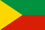
Chita Oblast
Chita Oblast
|
|||||
|---|---|---|---|---|---|
| State : | Russia | ||||
| Federal District : | Siberia | ||||
| Area : | 412,300 km² | ||||
| Residents : | 1,128,238 (January 1, 2006) | ||||
| Inventory time: | September 26, 1937 - March 1, 2008 | ||||
| Capital : | Chita | ||||
| Population density : | 2.7 inhabitants per km² | ||||
| License plate : |
75
|
||||
The Chita Oblast ( Russian Читинская область / Tschitinskaja oblast ) was an administrative region in Russia .
The oblast was in southern Siberia , it bordered with Mongolia and China . It comprised the eastern part of the Jablonowy Mountains and the upstream hill country. The most important rivers were the Argun as a border river to China and the Shilka . The Agin Buryat Autonomous Okrug was enclosed by the oblast . Both areas became the Transbaikalia region on March 1, 2008 (Забайκальский край = Zabajkal'skij kraj).
Russian colonization of the region began in the second half of the 17th century, but Chita was only a small village and city in exile until the 19th century. At the beginning of the 20th century, the Trans-Siberian Railway reached the oblast.
Iron ore, copper and coal are among the most important mineral resources; others are suspected to be in the undeveloped areas. The steel industry and mechanical engineering are the most important branches of industry.
The capital and only major city of the oblast was Chita .
Biggest cities
| city | Russian name | Residents (January 1, 2006) |
|---|---|---|
| Chita | Чита | 306.239 |
| Krasnokamensk | Краснокаменск | 55,822 |
| Borsja | Борзя | 30,737 |
| Petrovsk-Sabaikalsky | Петровск-Забайкальский | 20,334 |
| Nerchinsk | Нерчинск | 14,490 |
| Shilka | Шилка | 14,371 |
See also: List of cities in Chita Oblast
Web links
- Official website of Chitinskaya Oblast (Russian)


