Ohmberg
| Ohmberg | ||
|---|---|---|
|
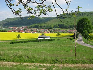
The Ohmberg (left) in the northeast Ohm Mountains |
||
| height | 528.7 m above sea level NHN | |
| location | Eichsfeld district , Thuringia ( Germany ) | |
| Mountains | Ohm Mountains | |
| Coordinates | 51 ° 28 ′ 55 " N , 10 ° 25 ′ 3" E | |
|
|
||
| rock | Shell limestone | |
The Ohmberg is a 528.7 m above sea level. NHN high mountain of the Ohm Mountains in the Eichsfeld district , northern Thuringia ( Germany ).
geography
The Ohmberg rises on the northeastern edge of the Ohm Mountains. Viewed clockwise, it is located between the communities of Holungen in the northwest, Bischofferode in the northeast, Hauröden in the east and Kaltohmfeld in the south, the nearest town Worbis is about 7 kilometers in a south-westerly direction.
The new rural community Am Ohmberg derives its name from the Ohmberg , which characterizes the localities.
nature
The completely forested Ohmberg is the northeastern branch of the Ohmgebirgsplateau. Immediately to the northwest of the highest point there is a free-standing shell limestone rock , the so-called Wild Church , to the east there is another rock formation, the Hauröder cliffs , from which one has a wide view to the north into the lower oak field to the Harz with the Brocken and to the east over the North Thuringian hill country to the Kyffhäuser Mountains . The mountain is an interesting hiking area and can only be reached on foot. To the south-east at the foot of the Ohmberg is the Marienthal forester's house , now a restaurant.
To the north and south-east of the Ohmberg are the former potash pits of Bischofferode and Neubleicherode .


