Kaltohmfeld
|
Kaltohmfeld
City of Leinefelde-Worbis
|
|
|---|---|
| Coordinates: 51 ° 27 ′ 20 ″ N , 10 ° 23 ′ 56 ″ E | |
| Height : | 494 (490-500) m above sea level NN |
| Residents : | 164 (Feb 29, 2016) |
| Incorporation : | March 14, 1974 |
| Incorporated into: | Kirchohmfeld |
| Postal code : | 37339 |
| Area code : | 036074 |
|
Location of Kaltohmfeld in Leinefelde-Worbis
|
|
|
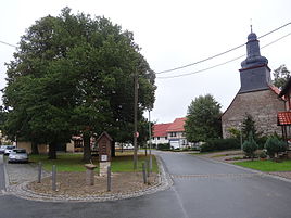
Village green
|
|
Kaltohmfeld is a district of Leinefelde-Worbis in the Eichsfeld district in Thuringia .
location
The place Kaltohmfeld is located on the southern edge of the Ohm Mountains , about five kilometers northeast of Worbis .
history
The first documentary mention took place in 1418. In the first third of the 16th century, Kaltohmfeld was a desert . A new settlement was started under Anna von Wintzingerode . In 1573 the residents of Kaltohmfeld came under the administration of Mainz , but retained the Protestant faith because of the close ties to the later count families of Wintzingerode. In 1588 a Protestant church (" John the Baptist ") was built on the edge of the village, which was torn down in 1655 and rebuilt. Kaltohmfeld later became part of Kirchohmfeld.
politics
Bettina Recke was elected mayor of Kaltohmfeld on June 30, 2014.
military
Until about 1993 there was a Soviet radio direction finding station north of the village.


