
Olszana
| Olszana | |||
|---|---|---|---|
 Help on coat of arms |
|
||
| Basic data | |||
| State : | Poland | ||
| Voivodeship : | Lesser Poland | ||
| Powiat : | Nowy Sącz | ||
| Gmina : | Podegrodzie | ||
| Area : | 7.97 km² | ||
| Geographic location : | 49 ° 34 ' N , 20 ° 31' E | ||
| Height : | 360 m npm | ||
| Residents : | 1785 (2010) | ||
| Postal code : | 33-386 | ||
| Telephone code : | (+48) 18 | ||
| License plate : | KNS | ||

Olszana is a village with a Schulzenamt of the municipality Podegrodzie in the powiat Nowosądecki of the Lesser Poland Voivodeship , Poland .
geography
The place is by the river Jastrzębik in Inselbeskiden ( Beskid Wyspowy ).
The village has an area of 797 ha (12.3% of the rural parish).
The neighboring towns are Olszanka in the southeast, Szczereż in the south, Łącko in the southwest, Czarny Potok in the west, Jadamwola in the north.

The village in the parish

history
The place was first mentioned in 1289 as Olsana . The name is derived from the alder (Polish olsza ). In 1317 it was founded under Magdeburg law . He originally belonged to the Poor Clares in Stary Sącz.
After the first partition of Poland , Olszana became part of the new Kingdom of Galicia and Lodomeria of the Habsburg Empire (from 1804). In 1900 the village had 630 inhabitants, all of them Polish-speaking and Roman Catholic.
In 1918, after the end of the First World War and the collapse of the Austro-Hungarian monarchy, Olszana came to Poland. This was interrupted by the occupation of Poland by the Wehrmacht in World War II , during which it belonged to the Generalgouvernement .
From 1975 to 1998 Olszana was part of the Nowy Sącz Voivodeship .
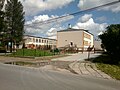
school

Web links
Individual evidence
- ↑ Ludwig Patryn (Ed.): Community encyclopedia of the kingdoms and countries represented in the Reichsrat, edited on the basis of the results of the census of December 31, 1900, XII. Galicia . Vienna 1907.

Brzezna | Chochorowice | Długołęka-Świerkla (Langendorf-Tannendorf) | Gostwica | Juraszowa (Jörgenau) | Mokra Wieś (Nassendorf) | Naszacowice (Naschatowitz) | Olszana | Olszanka (Ollschau) | Podegrodzie (Zaundorf) | Podrzecze (Unterbach) | Rogi | Stadła (Stadlau)