
Stadła
| Stadła | |||
|---|---|---|---|
 Help on coat of arms |
|
||
| Basic data | |||
| State : | Poland | ||
| Voivodeship : | Lesser Poland | ||
| Powiat : | Nowy Sącz | ||
| Gmina : | Podegrodzie | ||
| Area : | 3.67 km² | ||
| Geographic location : | 49 ° 35 ' N , 20 ° 37' E | ||
| Residents : | 842 (2010) | ||
| Postal code : | 33-386 | ||
| Telephone code : | (+48) 18 | ||
| License plate : | KNS | ||

Stadła (until 1964 Stadło , German Stadlau ) is a village with a Schulzenamt of the municipality Podegrodzie in the powiat Nowosądecki of the Lesser Poland Voivodeship in Poland .
geography
The place is located on the left bank of the Dunajec River in the Sandez basin .
The village has an area of 367 hectares (5.6% of the rural parish).
The neighboring towns are Gostwica and Brzezna in the north, the town of Stary Sącz (Alt Sandez) in the southeast, Podegrodzie in the southwest.
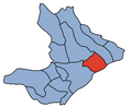
The village in the parish

history
The place was first mentioned in the early 15th century as Stadla . The name is of unclear origin but is probably derived from the word stadło ( herd (Polish stado), a couple , females with males ). Stadło did not come into use until the 19th century. The village originally belonged to the Poor Clares in Stary Sącz.
During the first partition of Poland in 1772, Stadła became part of the new Kingdom of Galicia and Lodomeria of the Habsburg Empire (from 1804).

In 1788 German Lutherans were settled there in the course of the Josephine colonization . This colony originally counted 20 families from the Palatinate and Nassau . In 1806 they built a house of prayer. The community belonged to the Evangelical Superintendenty AB Galizien . In addition to Stadło, this parish also included Podrzecze , Świniarsko , Świerkla , Mokra Wieś , Juraszowa , Naszacowice , Stary Sącz , Barcice , Rytro , Gołkowice (from 1850 the seat of a branch parish), Gaboń , Olszanka , Skrudzina and Kadcudzina . In 1875 the community had 834 souls (including 87 in Stadło). The colonists had a German school since 1878, with a new building after 1889. Most of them were Polonized by the end of the 19th century. In 1900 the village had 401 inhabitants, of which 399 were Polish-speaking, 2 German-speaking, 225 were Roman Catholic, there were 23 Jews and 153 of other faiths (mostly Protestant).
In 1918, after the end of the First World War and the collapse of the Austro-Hungarian monarchy, Stadła came to Poland. In 1921 the census in Stadło included 337 Roman Catholics and 16 Jews as well as 105 Lutherans, but only 2 people who stated German nationality. This was interrupted by the occupation of Poland by the Wehrmacht in World War II , during which it belonged to the Krakow district in the Generalgouvernement . In the summer of 1944 the remaining Germans were evacuated, including the majority of the Polonized Protestants. The evangelical congregation was united with Nowy Sącz / Neu Sandez and today has only around 80 members. The former evangelical prayer house was moved to Świniarsko after the Second World War , and since 2003 it has been in the open-air museum in Falkowa , the department of the Josephine colonists.
From 1975 to 1998 Stadła was part of the Nowy Sącz Voivodeship .
Attractions
- Evangelical cemetery (around 1000 dead were buried here between 1783 and 1945)
- German colonist houses (early 19th century)

Evangelical cemetery

former houses of the German colonists


Web links
Individual evidence
- ↑ Władysław Lubas: nazwy miejscowe Południowej części dawnego województwa Krakowskiego . Polska Akademia Nauk . Instytut Języka Polskiego, Wrocław 1968, p. 140-141 (Polish, online ).
- ↑ Henryk Lepucki: Działalność kolonizacyjna Marii Teresy i Józefa II w Galicji 1772-1790: z 9 tablicami i MAPA . Kasa im. J. Mianowskiego, Lwów 1938, p. 163-165 (Polish, online ).
- ↑ Dariusz Gacek: Beskid Wyspowy. Przewodnik . Oficyna Wydawnicza "Rewasz", Pruszków 2012, ISBN 978-83-62460-25-0 , p. 301-302 (Polish).
- ↑ Schematism of the Evangelical Church in Augsb. and Helvet. Confession in the kingdoms and countries represented in the Austrian Imperial Council . Vienna 1875, p. 194-195 ( online ).
- ↑ Ludwig Patryn (Ed.): Community encyclopedia of the kingdoms and countries represented in the Reichsrat, edited on the basis of the results of the census of December 31, 1900, XII. Galicia . Vienna 1907.
- ↑ Główny Urząd Statystyczny: Skorowidz miejscowości Rzeczypospolitej Polskiej. Województwo krakowskie i Śląsk Cieszyński . Warszawa 1925, p. 26 [PDF: 36] (Polish, Woj.krakowskie i Sląsk Cieszynski miejscowości.pdf ).

Brzezna | Chochorowice | Długołęka-Świerkla (Langendorf-Tannendorf) | Gostwica | Juraszowa (Jörgenau) | Mokra Wieś (Nassendorf) | Naszacowice (Naschatowitz) | Olszana | Olszanka (Ollschau) | Podegrodzie (Zaundorf) | Podrzecze (Unterbach) | Rogi | Stadła (Stadlau)