Ordos Plateau
| Ordos desert
Erdos Shamo (鄂爾多斯 沙漠)
|
||
|---|---|---|
| location |
|
|
|
|
||
| Coordinates | 39 ° 0 ′ N , 108 ° 0 ′ E | |
| rock | Sand (22,500 km 2 ) | |
| surface | 90,000 km² | |
|
Ordos (area of the prefecture-level city ) |
||
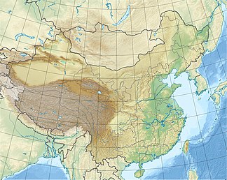
The Ordos Plateau is a steppe and desert landscape in the Inner Mongolia Autonomous Region in the north of the People's Republic of China . The region used to be called He-tau and later He-nan ("land south of the river"). The plateau has an average height of 1200 m above sea level. NN and is now mostly part of the administrative area of the city of Ordos .
location
The plateau is framed in the west, north and east by the great arch of the Yellow River . North of the Yellow River Mountains separate the Kara-Naryn-ula, Sheitenula, and in Shan - foothills of the Hinggan - the plain of the Gobi . In the south and east, the Great Wall separates the plateau from the fertile loess area of Shaanxi . The area is about 90,000 km². The Ordosebene covering the southern part of Inner Mongolia, but also the autonomous region Ningxia the Hui and Shaanxi and Gansu .
Desert character
The northern part of the plateau consists of steppes and semi-deserts, which in places turn into sandy desert . Even if it is more of a steppe than a desert, some scientists classify it as part of the Alashan or Gobi desert . In the southern part, there is occasional, modest farming possible if there is enough water available through rivers. Precipitation increases from west to east, and in this direction extensive livestock farming of sheep and goats changes over to normal agriculture. In the north, only grasses and isolated bushes grow (e.g. sagebrush on the dunes in the north), while in the south there are more bushes and denser vegetation.
relief
The desert can be viewed as the intermediate level between the Himalayas and the Tibetan plateau and the lowlands in eastern China. Towards the south it rises to an altitude of over 1,500 m. In the west, the Arbisoberge run along the Yellow River. They tower over the plain by about 900 m and represent a link to the Alashan .
The northern part of the great river arch is covered with 12 to 15 m high dunes. In some places these dunes reach close to the river, in other places there is a separating belt of sand and clay in between, which forms cliffs that can be up to 30 m above the river. The sand dunes can also continue on the opposite bank, where they are crossed by dry river beds.
The In Shan north of the river differs from the other mountains in southern Mongolia by the water and the consequent rich vegetation. One mountain range, the Munni-ula, is also characterized by steep flanks and narrow, rough gorges.
Historical meaning
Due to its location and fertility, it was a feeding area for the animals of the northern nomadic tribes such as the Xiongnu or Mongols and thus often served as a gateway for the catastrophic raids in China.
After 781, the Tibetans took large parts of the area under their control. From 982 to 1227 it was under the rule of the Tangut Xixia
population
The area was occupied for several centuries by nomadic horsemen who were often at war with the Chinese government. Possibly they were also Eastern Turks . It belonged to the Xiongnu in the first and second centuries AD . After the uprising of the Muslim minority, the Hui Chinese , in 1869, the country was partially depopulated.
In 1989, the population of the Ordos Plateau was 1.2 million, of which 88% were Han Chinese and only 12% were Mongols . 83% of the population lived in the country, 17% in cities.
climate
The climate of the Ordos is characterized by dry and cold winters and humid and warm summers. The annual precipitation amounts to 200 mm in the west and up to 450 mm in the east, which fall mainly during thunderstorms between June and September. In January, the average temperature is between -13 and -10 ° C, plus cold winds from the north and west. Precipitation, however, shows great variability , so that the risk of drought is quite high. An additional climatic feature is the frequent occurrence of strong winds.
The soil consists of a mixture of clay and sand , which is why it is not very suitable for agriculture. The area has some soda deposits that are being mined. A considerable part of the soils of the Ordos is degraded because, on the one hand, in the 20th century - especially between 1958 and 1962 and between 1967 and 1972 - around 20% of the pastures were converted into arable land. On the other hand, overgrazing took place due to the increase in population , as more and more cattle were kept on the same area. Both together, in connection with the natural fluctuations in precipitation, led to increasing erosion of the unstable sand and loess soils and thus to desertification .
See also
literature
- Jürgen Paul : Central Asia. S. Fischer, Frankfurt am Main 2012 ( New Fischer World History , Volume 10).


