Osterbach (Gersprenz)
|
Osterbach Easter |
||
|
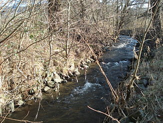
The Osterbach just before the confluence |
||
| Data | ||
| Water code | DE : 247612 | |
| location | Odenwaldkreis , Hessen ( Germany ) | |
| River system | Rhine | |
| Drain over | Gersprenz → Main → Rhine → North Sea | |
| source | in Odenwald at Fürth -Weschnitz 49 ° 39 '28 " N , 8 ° 50' 58" O |
|
| confluence | with the Mergbach near Reichelsheim -Bockenrod to Gersprenz Coordinates: 49 ° 42 '24 " N , 8 ° 51' 32" E 49 ° 42 '24 " N , 8 ° 51' 32" E
|
|
| length | 7 km | |
| Catchment area | 19.934 km² | |
| Drain at the mouth |
MQ |
280.5 l / s |
|
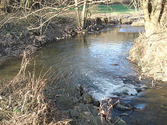
The Osterbach (front right) joins the Mergbach (left) to the Gersprenz (back right) |
||
The Osterbach , also known as Easter , in the Odenwald is the approximately 7 km long, southern and orographically right source brook of the Gersprenz in the Odenwaldkreis in southern Hesse . It is also seen by some as a tributary of her.
geography
course
The Osterbach rises near Fürth - Weschnitz on the northern slope of the Kahlberg ( 520.6 m above sea level ). It flows together with the Mergbach to the Gersprenz near Reichelsheim - Bockenrod .
Tributaries
- Brook from the thick hedge ( right ), 1.8 km
- Erzbach ( right ), 1.8 miles
- Rohrbach ( right ), 4.0 km
- Irrbach ( left ), 2.1 km
- Formbach ( right ), 2.6 km
Gersprenz river system
Localities
- Fürth - Weschnitz
- Reichelsheim - Upper Easter
- Reichelsheim- Unter-Easter
- Reichelsheim- Bockenrod
Web links
Commons : Osterbach - Collection of images, videos and audio files

