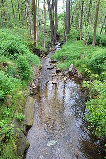
Pekelský potok (Smědá)
|
Pekelský potok Telke, Telkebach |
||
| Data | ||
| Water code | CZ : 2-04-10-012 | |
| location | Czech Republic | |
| River system | Or | |
| Drain over | Smědá → Lusatian Neisse → Oder → Baltic Sea | |
| source | west of Přebytek , Jizera Mountains foothills 50 ° 53 ′ 54 ″ N , 15 ° 11 ′ 40 ″ E |
|
| Source height | 405 m nm | |
| muzzle | in Luh in the Smědá coordinates: 50 ° 54 ′ 2 ″ N , 15 ° 8 ′ 15 ″ E 50 ° 54 ′ 2 ″ N , 15 ° 8 ′ 15 ″ E |
|
| Mouth height | 329 m nm | |
| Height difference | 76 m | |
| Bottom slope | 19 ‰ | |
| length | 4 km | |
| Catchment area | 4.98 km² | |
The Pekelský potok (German Telke , also Telkebach ) is a right tributary of the Smědá ( Wittig ) in the Czech Republic .
course
The Pekelský potok rises west of Přebytek at the foot of the Závorník ( Riegelberg , 695 m above sea level) in the Jizera foothills . On its course to the west, the brook flows through Peklo , where it joins the Ludvíkovský vrch (481 m above sea level) in the north and Dubový vrch ( Eichberg , 467 m above sea level) and Pekelský vrch ( Höllberg , 487 m above sea level) in the north m above sea level) forms enclosed hell ground. Below Peklo, the Pekelský potok flows past the southern foothills of the Chlum ( High Grove , 495 m above sea level) and reaches Luh , where it flows past the stadium and open-air swimming pool and, after four kilometers opposite the Raspenau Church, flows into the Smědá .
Most of the run leads through the Peklo Nature Park.
history
Remnants of dams from several ponds suggest that the water power of the Telke was used in the 16th century to operate a stamping mill for the ironworks on Stolpich near Raspenau . The oldest news about a settlement of the Telketal comes from 1601 when a Vorwerk in the Hell ( Frowergen in Heller ) was mentioned. The small settlement of Hellen was built around the manorial Meierhof at the beginning of the 18th century . In 1780 the owner of the Friedland estate , Christian Philipp von Clam-Gallas , had the village of Karolinthal ( Peklo ) laid out in the corridors of the Meierhof .
Tributaries
- nameless brook from the pond Petr (l), Peklo
- nameless brook (r), near Luh
Petr
The Petr reservoir is located on an unnamed tributary of the Pekelský potok in the valley between the Dubový vrch and the Pekelský vrch. The pond named after Petr Krumphanzel in 1986 has an area of 4,098 hectares. There is an island in the southern part. It is used for fishing and is also used for swimming. A peat store causes the water to turn brown.
Individual evidence
- ↑ https://is.muni.cz/th/222783/prif_b/Lenka_MUSILOVA_bakalarska_prace.txt
- ↑ https://is.muni.cz/th/222783/prif_b/Lenka_MUSILOVA_bakalarska_prace.txt
- ↑ https://maps.kraj-lbc.cz/mapserv/rybniky/detail_view.php?id=1695
- ↑ http://www.laznelibverda.cz/cs/turisticke-informace/tipy-na-vylet/koupani-v-prirode/rybnik-petr-osada-peklo.html
