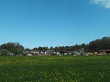
Pietzing


Pietzing is one of 70 parts of the municipality of Riedering in the Upper Bavarian district of Rosenheim and a district .
Geographical location
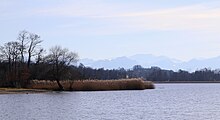
The village of Pietzing is located on the eastern bank of the Simsee near the mouth of the Fellbach , just under four kilometers northeast of the center of Riedering and around eight kilometers west of Prien am Chiemsee on the RO 16 district road .
history
The first information about the village comes from an exchange certificate made out in Rordorf ( Rohrdorf am Inn ) in 924 , in which Rihina, divorced wife of the Abterzbischhof Odalbert von Salzburg, receives a third of the church income in Selihoba ( Söllhuben ) and Piecinga (Pietzing) and but renounced the Seeon domain and other property. However, the two churches were released from this payment obligation in 927. In 1140, Margrave Engelbert von Kraiburg gave away a courtyard and a building site in villa Pitzingen to the Frauenchiemsee monastery . On November 25, 1314, Ruger von Schalchem ceded the Baumgarten zu Pletzing to the Frauenchiemsee monastery .
The municipality of Pietzing had 470 inhabitants and 21 places at the 1961 census. On May 1, 1978 Pietzing was dissolved as an independent municipality. The towns of Herrgottswinkel , Hitzing , Kindlpoint and Ratzing were incorporated into Rimsting , Asbichl , Kronlohe and Ulperting were incorporated into the Bad Endorf market , all other parts of the community were reclassified to Riedering .
Demographics
| year | population | Remarks |
|---|---|---|
| 1840 | 339 | |
| 1853 | 310 | in 70 families |
| 1861 | 338 | |
| 1871 | 340 | on December 1st in 66 residential buildings, spread over 24 residential areas |
| 1880 | 340 | |
| 1900 | 392 | |
| 1910 | 407 | |
| 1919 | 447 | |
| 1925 | 437 | |
| 1933 | 428 | |
| 1939 | 408 | |
| 1946 | 636 | |
| 1952 | 525 | |
| 1961 | 470 | |
| 1970 | 477 | |
| 1977 | 421 | on December 31, excluding the places of residence of Hitzing , Kindlpoint , Ratzing , Kronlohe and Ulperting and the Asbichl estate |
Parish
The Catholics of Pietzing visit the church in Pietzenkirchen , which is a branch of the parish in Söllhuben and whose patron is St. Stephen and St. Laurentius are.
literature
- Karl Detterbeck and Konrad Breitrainer: Riederinger Heimatbuch , published by the municipality of Riedering, Riedering 1988, 801 pages.
Web links
- Pietzing in the location database of the Bayerische Landesbibliothek Online . Bavarian State Library
Individual evidence
- ↑ a b Karl Detterbeck and Konrad Breitrainer: Riederinger Heimatbuch , published by the municipality of Riedering, Riedering 1988, p. 356.
- ↑ Sebastian Dachauer : On the history of the church on Petersberge and the castles Falkenstein, Kirnstein and Auerburg . In: Upper Bavarian Archive for Fatherland History , Volume 2, Munich 1840, pp. 356–401, especially pp. 367–369 ( online )
- ^ Upper Bavarian Archive for Fatherland History , Volume 5, Munich 1843, p. 149 ( online ).
- ↑ ibid., P. 160 ( online )
- ↑ Martin von Deutinger (Ed.): Contributions to the history, topography and statistics of the Archdiocese of Munich and Freysing , Volume 1, Munich 1850, p. 300 ( online ).
- ↑ Bavarian State Statistical Office (ed.): Official city directory for Bavaria, territorial status on October 1, 1964 with statistical information from the 1961 census . Issue 260 of the articles on Bavaria's statistics. Munich 1964, DNB 453660959 , Section II, Sp. 187 ( digitized version ).
- ↑ Bavarian State Office for Statistics and Data Processing (Hrsg.): The municipalities of Bavaria according to the territorial status May 25, 1987. The population of the municipalities of Bavaria and the changes in the acquisitions and territory from 1840 to 1987 (= contributions to Statistics Bavaria . Issue 451). Munich 1991, p. 53–54 , urn : nbn: de: bvb: 12-bsb00070717-7 ( digitized version - Rosenheim district; footnotes 25, 26 and 10).
- ↑ a b c d e f g h i j k Bavarian State Statistical Office (Hrsg.): Historical municipality directory: The population of the municipalities of Bavaria from 1840 to 1952 (= contributions to Statistics Bavaria . Issue 192). Munich 1954, DNB 451478568 , p. 39 , urn : nbn: de: bvb: 12-bsb00066439-3 ( digitized version ).
- ↑ Karl Detterbeck and Konrad Breitrainer: Riederinger Heimatbuch , published by the municipality of Riedering, Riedering 1988, pp. 178–180.
- ↑ Kgl. Statistical Bureau (ed.): Complete list of localities of the Kingdom of Bavaria. According to districts, administrative districts, court districts and municipalities, including parish, school and post office affiliation ... with an alphabetical general register containing the population according to the results of the census of December 1, 1875 . Adolf Ackermann, Munich 1877, 2nd section (population figures from 1871, cattle figures from 1873), Sp. 249 , urn : nbn: de: bvb: 12-bsb00052489-4 ( digitized version ).
- ↑ Bavarian State Statistical Office (ed.): Official city directory for Bavaria, territorial status on October 1, 1964 with statistical information from the 1961 census . Issue 260 of the articles on Bavaria's statistics. Munich 1964, DNB 453660959 , Section II, Sp. 187 ( digitized version ).
- ^ Bavarian State Statistical Office (ed.): Official place directory for Bavaria . Issue 335 of the articles on Bavaria's statistics. Munich 1973, DNB 740801384 , p. 50 ( digitized version ).
- ↑ Karl Detterbeck and Konrad Breitrainer: Riederinger Heimatbuch , published by the municipality of Riedering, Riedering 1988, p. 218.
Coordinates: 47 ° 52 ' N , 12 ° 15' E