Pihtla (rural community)
| Pihtla | |||
|
|||
| State : |
|
||
| Circle : |
|
||
| Coordinates : | 58 ° 18 ' N , 22 ° 42' E | ||
| Area : | 228.11 km² | ||
| Residents : | 1,486 (2006) | ||
| Population density : | 7 inhabitants per km² | ||
| Time zone : | EET (UTC + 2) | ||
| Community type: | former rural community | ||

|
|||
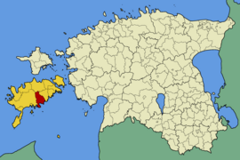
Pihtla (German: Pichtendahl ) is a former rural community in the Estonian Saare district on the island of Saaremaa with an area of 228.11 km². It had 1486 inhabitants (2006). In 2017 all municipalities on Saaremaa merged to form the new rural municipality Saaremaa .
Pihtla was east of the island's capital Kuressaare . The oldest place in the community, the village of Püha, was first mentioned in a document in 1449. In addition to the main town Pihtla (94 inhabitants) comprised the rural community of the villages eiste , Ennu , Hämmelepa , Haeska , Iilaste , Ilpla , Kaali , Kailuka , Kangrusselja , Kiritu , Kõljala , Kõnnu , Kuusiku , Laheküla , Leina , Liiva , Liiva-Putla , Masa , Matsiranna , Metsaküla , Mustla , Nässuma , Püha , Rahniku , Räimaste , Rannaküla , Reeküla , Reo , Sagariste , Salavere , Sandla , Sauaru , Saue-Putla , Sepa , Sutu , Suure-Rootsi , Tõlluste , Väike-Rootsi , Väljaküla and Vanamõisa .
The Kaali meteorite crater was on the territory of the municipality . Architectural sights were the manor houses of Kõljala and Tõlluste as well as the church of Püha.

