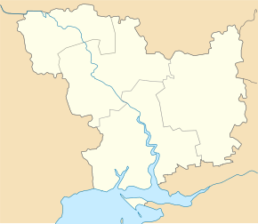
Pokrovka (Ochakiv)
| Pokrovka | ||
| Покровка | ||

|
|
|
| Basic data | ||
|---|---|---|
| Oblast : | Mykolaiv Oblast | |
| Rajon : | Ochakiv district | |
| Height : | 0 m | |
| Area : | 5.275 km² | |
| Residents : | 229 (2004) | |
| Population density : | 43 inhabitants per km² | |
| Postcodes : | 57555 | |
| Area code : | +380 5154 | |
| Geographic location : | 46 ° 29 ′ N , 31 ° 42 ′ E | |
| KOATUU : | 4825183201 | |
| Administrative structure : | 3 villages | |
| Address: | вул. Морозівська буд. 22 57555 с. Покровка |
|
| Website : | City council website | |
| Statistical information | ||
|
|
||
Pokrovka ( Ukrainian Покровка ; Russian Покровка ) is a village in the south of the Ukrainian Oblast Mykolaiv with about 380 inhabitants (2004).
The village, which was founded by fled serfs from the Chernigov governorate in the second half of the 18th century, is located in the west of the Kinburn Peninsula, southeast of the district capital of Ochakiv, on the opposite bank of the Dnieper-Bug Liman and on the Jahorlyzkyj Bay .
Pokrowka is the administrative center of a district council in Ochakiv district , which also includes the villages of Vasylivka and Pokrowske . The Kinburn Spit is within the county council . Kinburn Fortress was located there until 1857 .
Individual evidence
- ^ Website of the village on the official website of the Verkhovna Rada , accessed on July 30, 2015
- ^ Local history Pokrovka in the history of the cities and villages of the Ukrainian SSR ; accessed on July 31, 2020 (Ukrainian)


