Qara Valley
|
Qaratal Қаратал upper course: Qora (Қора) |
||
|
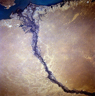
Lower course of the Qara valley |
||
| Data | ||
| location | Köksu , Eskeldi , Qaratal in the Almaty region ( Kazakhstan ) | |
| River system | Qara Valley | |
| source |
Djungarian Alatau 44 ° 54 ′ 29 ″ N , 79 ° 25 ′ 38 ″ E |
|
| muzzle |
Lake Balkhash coordinates: 46 ° 28 '31 " N , 77 ° 13' 7" E 46 ° 28 '31 " N , 77 ° 13' 7" E |
|
| Mouth height |
338 m
|
|
| length | 390 km | |
| Catchment area | 19,100 km² | |
| Discharge at the Üschtöbe gauge |
NNQ MQ MHQ |
0 l / s 55 m³ / s 359 m³ / s |
| Left tributaries | Tschascha , Köksu | |
| Big cities | Taldyqorghan | |
| Medium-sized cities | Tekeli , Üschtöbe | |
| Small towns | Qarabulaq | |
|
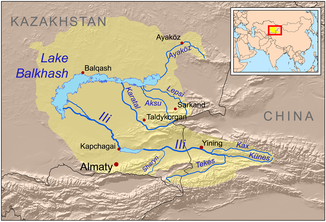
Course of the Qara Valley (Karatal) |
||
The Qara Valley ( Kazakh Қаратал - " Black Willow ") is a 400 km long river in eastern Kazakhstan .
The name may come from the fact that the river has very dark water during the dew times. It rises in the southwest of the up to 4463 m high Djungarian Alatau . In the upper reaches, above the confluence of the Chascha in the city of Tekeli , the river is called Qora (Қора). It flows west through the mountains. From Tekeli it flows in a wide valley. It flows past Qarabulaq and Taldyqorghan , picks up the Köksu from the left, passes Üschtöbe and flows mainly in a north-westerly direction through a desert steppe into the outflowless Lake Balkhash . The city of Qarabulak is named after the Qara valley.
Individual evidence
- ↑ a b Article Qaratal in the Great Soviet Encyclopedia (BSE) , 3rd edition 1969–1978 (Russian)
- ↑ http://www.grdc.sr.unh.edu/html/Polygons/P2914450.html Global River Discharge Monitoring

