Río Fortaleza
| Río Fortaleza | ||
|
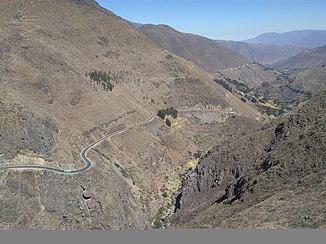
Río Fortaleza near Cajacay |
||
| Data | ||
| location |
|
|
| River system | Río Fortaleza | |
| Headwaters | Lagunas Macato, Cordillera Negra 10 ° 14 ′ 34 ″ S , 77 ° 14 ′ 30 ″ W |
|
| Source height | approx. 4600 m | |
| muzzle |
Pacific Ocean Coordinates: 10 ° 38 ′ 51 ″ S , 77 ° 51 ′ 38 ″ W 10 ° 38 ′ 51 ″ S , 77 ° 51 ′ 38 ″ W |
|
| Mouth height | 0 m | |
| Height difference | approx. 4600 m | |
| Bottom slope | approx. 40 ‰ | |
| length | approx. 115 km | |
| Catchment area | approx. 2340 km² | |
| Left tributaries | Quebrada Paraíso, Río Purísima, Quebrada Choque | |
| Right tributaries | Río Marca, Río Huayllapampa, Quebrada Rari | |
| Communities | Cajacay , Raquía , Chaucayán, Chasquitambo | |
The Río Fortaleza ( Fortaleza Spanish for “fortress”) is an approx. 115 km long tributary of the Pacific Ocean in central western Peru in the provinces of Bolognesi , Recuay and Barranca . The famous archaeological site Fortaleza de Paramonga is located 2 km from the mouth on the right bank of the river .
River course
The Río Fortaleza rises in the Cordillera Negra , a mountain range of the Peruvian Western Cordillera , in the province of Bolognesi at an altitude of about 4600 m . The rivers Río Santa and Río Ocros have their source in the source region . For the first 25 km the Río Fortaleza flows to the northwest. He then turns west for the next 15 kilometers. The places Cajacay and Raquía lie south of the upper reaches. From river kilometer 100 the national road 16 runs along the river until shortly before the mouth of the Río Fortaleza. Between river kilometers 95 and 60, the river forms the border between the northern province of Recuay and the province of Bolognesi. The Río Fortaleza turns in the middle and lower reaches towards the south-southwest. He passes the places Chaucayán and Chasquitambo . At river km 50 he reaches the province of Barranca. The Río Fortaleza finally flows into the sea north of the city of Paramonga , 16 km northwest of the provincial capital Barranca and 180 km north-northwest of the state capital Lima . On the lower 16 kilometers, the Río Fortaleza flows through the coastal lowlands, where extensive irrigated agriculture is practiced.
Catchment area and hydrology
The Río Fortaleza drains an area of about 2340 km². The catchment area borders on that of the Río Huarmey to the north, that of the Río Santa to the northeast and that of the Río Pativilca to the east and south . The Río Fortaleza has very little water from July to September.
