Randolph Air Force Base
| Randolph Air Force Base | |
|---|---|

|
|
| Characteristics | |
| ICAO code | KRND |
| IATA code | RND |
| Coordinates | |
| Height above MSL | 232 m (761 ft ) |
| Transport links | |
| Distance from the city center | 27 km northeast of San Antonio |
| Street | I-10 / I-35 / TX 1604 |
| Runways | |
| 14R / 32L | 2546 m × 61 m |
| 14L / 32R | 2545 m × 61 m concrete |
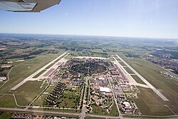
The Randolph Air Force Base (in short: Randolph AFB ) is an air base of the United States Air Force , located in Bexar County , Texas , about 27 kilometers northeast of San Antonio is located. The base was put into service on June 20, 1930 as a flight training base and is still used for this purpose today. It serves as the headquarters of the Air Education and Training Command , the education and training command of the US Air Force. Since 2010 it has been part of the Joint Base San Antonio .
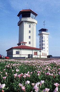
The central portion of the property has been listed on the National Register of Historic Places as a Historic District under the designation Randolph Field Historic District since July 1996 . In August 2001, the district was granted National Historic Landmark status.
Web links
Individual evidence
- ↑ Randolph Field Historic District on the National Register of Historic Places , accessed February 24, 2020.
- ↑ Listing of National Historic Landmarks by State: Texas. National Park Service , accessed February 24, 2020.
