Ravenna (Ohio)
| Ravenna | ||
|---|---|---|
 Downtown Ravenna |
||
| Location in Ohio | ||
|
|
||
| Basic data | ||
| Foundation : | 1799 | |
| State : | United States | |
| State : | Ohio | |
| County : | Portage County | |
| Coordinates : | 41 ° 10 ′ N , 81 ° 14 ′ W | |
| Time zone : | Eastern ( UTC − 5 / −4 ) | |
| Residents : | 11,771 (as of: 2000) | |
| Population density : | 846.8 inhabitants per km 2 | |
| Area : | 13.9 km 2 (approx. 5 mi 2 ) of which 13.9 km 2 (approx. 5 mi 2 ) is land |
|
| Height : | 345 m | |
| Postal code : | 44266 | |
| FIPS : | 39-65592 | |
| GNIS ID : | 1061586 | |
| Website : | www.ci.ravenna.oh.us | |
| Mayor : | Joseph Bica | |
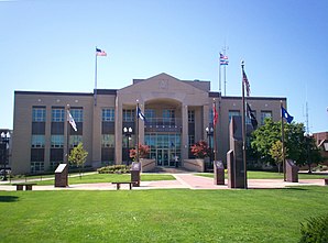
 Portage County Courthouse in Ravenna |
||
Ravenna is a city in the US state of Ohio and is the county seat of Portage County . In the 2000 census , the place had 11,771 inhabitants.
history
In 1799 Benjamin Tappan was the first white settler to settle at the place he named after Ravenna in Italy. The first school opened in 1803. Ravenna, which was originally in Trumbull County , was designated in 1808 as the administrative seat of Portage County. The first courthouse was built in 1810.
In 1846 there were about 1200 people in Ravenna. In 1848 a glassworks started operations, which is now considered to be the first industrialization in the city. The Cleveland and Pittsburgh Railroad reached the place in 1851. In 1880 Ravenna already had 3,255 inhabitants.
During the Second World War , Ravenna became a location for the arms industry. Ammunition was produced in large numbers in the so-called Ravenna Arsenal . A total of around 14,000 people worked here. After the end of the war, the main focus was on the production of fertilizers, before ammunition production was restarted for both the Korean War and the Vietnam War .
In the spring of 1981, teachers in Ravenna - like some other cities in Ohio - went on strike for better working conditions and higher salaries. The Ravenna strike lasted 85 days, making it the longest teacher strike in United States history.
traffic
Interstate 80 runs about 8 kilometers north of the city, and Interstate 76 (east) 5 kilometers south . The city also operates Portage County Airport , which is about three miles north of the city center.
sons and daughters of the town
- Henry Adoniram Swift (1823-1869), politician
- William Henry Howe (1846–1929), landscape and animal painter
- William R. Day (1849–1923), politician and Supreme Court Justice
- Anna Althea Hills (1882–1930), painter
- Edward Louis Heston CSC (1907–1973), Roman Catholic Curia Archbishop
- Curt Cacioppo (* 1951), composer and pianist
- Chris Bangle (* 1956), product designer
- Maynard James Keenan (* 1964), singer, record producer, actor and winemaker
- John Greco (born 1985), American football player
- Nate Hartley (born 1992), actor
Individual evidence
- ↑ a b c Ravenna, Ohio. Ohio History Central, accessed November 23, 2009 .
- ↑ a b Our History. (No longer available online.) City of Ravenna, archived from the original on May 2, 2009 ; accessed on November 23, 2009 . Info: The archive link was inserted automatically and has not yet been checked. Please check the original and archive link according to the instructions and then remove this notice.
- ^ Ravenna, Ohio, Teachers' Strike. Ohio History Central, accessed November 23, 2009 .
- ^ Portage County Airport. www.airnav.com, accessed November 23, 2009 .
