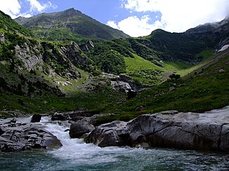
In there Sumvitg
| In there Sumvitg | ||
|
In the headwaters |
||
| Data | ||
| Water code | CH : 574 | |
| location | Switzerland , Canton of Graubünden | |
| River system | Rhine | |
| Drain over | Vorderrhein → Rhine → North Sea | |
| Headwaters | in the municipality of Blenio 46 ° 37 ′ 45 ″ N , 8 ° 57 ′ 14 ″ E |
|
| Source height | up to approx. 2927 m | |
| muzzle | near Surrein (Sumvitg municipality) in the Vorderrhein Coordinates: 46 ° 43 ′ 41 ″ N , 8 ° 57 ′ 32 ″ E ; CH1903: 716 213 / 176327 46 ° 43 '41 " N , 8 ° 57' 32" O |
|
| Mouth height | approx. 881 m above sea level M. | |
| Height difference | approx. 2046 m | |
| Bottom slope | approx. 11% | |
| length | 18.8 km | |
| Catchment area | 84.77 km² | |
| Discharge at the estuary A Eo : 84.77 km² |
MQ Mq |
3.16 m³ / s 37.3 l / (s km²) |
| Left tributaries | Rein da Vigliuts , Acla Mulin | |
| Right tributaries | Ouch there needle | |
| Communities | Lumnezia , Sumvitg | |
|
In Val Sumvitg |
||
The Rein da Sumvitg is an approximately 19 km long right tributary of the Vorderrhein in the Swiss canton of Graubünden . It drains the Val Sumvitg and its side valleys, including the Val Lavaz , an area of around 85 square kilometers. Along with the Glenner and Rabiusa, it is one of the most important tributaries of the Vorderrhein.
course
The Rein da Sumvitg rises between Piz Gaglianera and Piz Vial on the Gaglianera glacier above the Greina pass in the municipality of Lumnezia . Here it takes in several source streams, some of which arise in the canton of Ticino . The Rein da Sumvitg flows in a north-easterly direction through the Greina plateau . Between Piz Tgietschen and Piz Miezdi it changes course and flows in a north-westerly direction through the Val Sumvitg. It flows through the Runcahez equalization basin and flows into the Vorderrhein after around 19 km at Surrein . Its most important tributary is the Rein da Vigliuts , which flows into the Rein da Sumvitg at the Tenigerbad .
Individual evidence
- ↑ a b Geoserver of the Swiss Federal Administration ( information )
- ↑ Hydrological Atlas of Switzerland of the Federal Office for the Environment FOEN, Table_13
- ↑ a b Modeled mean annual discharge. In: Topographical catchment areas of Swiss waters: sub-catchment areas 2 km². Retrieved August 24, 2017 .


