Rettlkirchspitze
| Rettlkirchspitze / Keinhart | ||
|---|---|---|
|
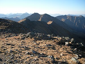
Rettlkirchspitze or Keinhart (middle) and eastern pre-summit (right of it) from the south ( Greim ) |
||
| height | 2475 m above sea level A. | |
| location | Styria , Austria | |
| Mountains | Wölzer Tauern , Niedere Tauern | |
| Dominance | 7.9 km → Schöderkogel | |
| Notch height | 687 m ↓ Sölkpass | |
| Coordinates | 47 ° 15 '36 " N , 14 ° 7' 39" E | |
|
|
||
| rock | Mica slate | |
The Rettlkirchspitze (also Rettel- and Rötelkirchspitze ) or the Keinhart is at 2475 m above sea level. A. the highest mountain in the Wölzer Tauern in Upper Styria .
Surname
The first part of the name rettel can be traced back to the color red and is derived from the reddish rock of the mountain. Church indicates a solitary, rocky mountain. In the older guides by Wödl and Jäckle, the name Keinhart is used instead of the official name Rettlkirchspitze (then officially Rötelkirchspitz ) . Jäckle particularly points out that the Rettlkirchspitze would be the correct name for the eastern pre-summit.
Location and structure
The Rettlkirchspitze rises in the area of the market town of St. Peter am Kammersberg about 9 kilometers north-north-west of the center. It is part of a ridge that branches off from the main Alpine ridge to the southeast at Hochstubofen ( 2385 m ) and separates Feistritzgraben from Eselbergergraben . The connection to the Hochstubofen is formed by the Rocklscharte . The ridge continues to the southeast over the Funklscharte to the almost equally high Greim ( 2474 m ), which forms the end of the ridge.
The Rettlkirchspitze is part of the mica slate zone of the Wölzer Tauern. Immediately south of the summit there are deposits of amphibolite as well as several inclusions of banded marble .
Climbs
The Rettlkirchspitze is far less important for tourism than neighboring Greims. The summit can only be reached via climbs that are not marked along the entire route. The best starting point in the Eselsberg Valley is the Neunkirchner Hütte ( 1535 m ), about 2 kilometers to the northeast , a self-catering hut of the Austrian Alpine Association .
- From the hut first to the west in the direction of Haseneckscharte , then over a steep step to the southeast up to the Funkl bottom . Before reaching the Funklscharte on the east ridge of the Rettlkirchspitze (marked with colored dots) and over a pre-summit to the highest point. Walking time: around 3 hours.
- From the hut longer to the west and only at an altitude of over 2000 meters to the southwest to the Rocklscharte just south of the Hochstubofen . Over the long, blocked northwest ridge (marked by stone men) to the summit of the Rettlkirchspitze. Walking time: 3 to 3½ hours.
Both climbs are technically not difficult , but still require surefootedness and generally alpine experience. The hiking guide authors Mokrejs and Ostermayer describe the crossing of the summit as “a Tauern delicacy for experts”.
A much longer ascent to the northwest ridge begins on the north ramp of the road over the Sölkpass .
literature
- Peter Holl: Alpine Club Guide Niedere Tauern , Bergverlag Rother , Munich 2005, 7th edition ISBN 3-7633-1267-6
- Adi Mokrejs, Max Ostermayer: Bergwander-Atlas Steiermark , Schall-Verlag, Alland 2009. ISBN 978-3-900533-57-1
Individual evidence
- ^ Federal Office for Metrology and Surveying Austria: Austrian Map online (Austrian map 1: 50,000) .
- ↑ Liselotte Buchenauer : Höhenwege in den Niederen Tauern , Bruckmann Verlag , Munich 1987, p. 52
- ^ Journal of the German and Austrian Alpine Association , Volume 24, p. 469
- ^ Journal of the German and Austrian Alpine Club , Volume 65, p. 125
- ^ Geological map of the Republic of Austria 1: 50,000, published by the Federal Geological Institute , Vienna 1979, sheet 129 Donnersbach
- ^ Mokrejs - Ostermayer: Bergwander-Atlas Steiermark , p. 380

