Rivière L'Assomption
| Rivière L'Assomption | ||
|
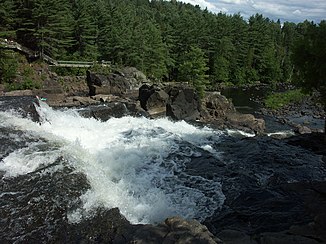
Rivière L'Assomption at the Parc des Chutes Monte-à-Peine in the regional county town of Matawinie |
||
| Data | ||
| location | Lanaudière in Quebec (Canada) | |
| River system | Saint Lawrence River | |
| Drain over | Rivière des Prairies → Saint Lawrence River → Atlantic Ocean | |
| origin |
Lac de L'Assomption in the Mont Tremblant massif 46 ° 27 ′ 45 ″ N , 74 ° 3 ′ 16 ″ W |
|
| muzzle |
Rivière des Prairies Coordinates: 45 ° 42 ′ 52 ″ N , 73 ° 28 ′ 51 ″ W 45 ° 42 ′ 52 ″ N , 73 ° 28 ′ 51 ″ W.
|
|
| length | 172 km | |
| Catchment area | 4222 km² | |
| Drain |
MQ |
83 m³ / s |
| Left tributaries | Rivière de la Boule , Rivière Noire | |
| Right tributaries | Rivière Versailles , Rivière Ouareau , Rivière Saint-Esprit , Rivière de l'Achigan | |
| Medium-sized cities | L'Assomption , Joliette , Repentigny | |
| Small towns | Charlemagne | |
| Residents in the catchment area | 150000 | |
|
The bend of the Rivière L'Assomption near the town of L'Assomption |
||
Rivière L'Assomption ( English Assomption River , named after the Assumption of the Virgin Mary ) is the main waterway in the Lanaudière region in the Canadian province of Québec .
The river has a length of 172 km and a catchment area of 4222 km². The source lies in the massif of Mont Tremblant . The seven main tributaries of the river are: Rivière de la Boule , Rivière Versailles , Rivière Noire , Rivière Ouareau , Rivière Saint-Esprit and Rivière de l'Achigan . Finally, the Rivière L'Assomption joins the Rivière des Prairies near Repentigny , just before it meets the Saint Lawrence River .
About 150,000 people live in the river's catchment area.
geography
The catchment area of the Rivière L'Assomption lies in two natural areas, the Laurentine Mountains and the St. Lawrence Lowland . The latter covers a third of the catchment area. Its relief corresponds to a plain with a few hills (with heights of up to 100 m). Agricultural land use dominates here. The fine-grained soil is located here over a slightly permeable layer of slate clay.
The Laurentian Mountains form part of the Canadian Shield . These are clearly delimited by a 150 m high layer step. There are a number of waterfalls along the stratum. The Laurentian Mountains have an average height of 230 m in the south and 460 m in the north. However, there are also higher mountains in the Mont Tremblant massif with heights of over 600 m. This is where the Rivière L'Assomption rises.
Hydrography
The average gradient of the water decreases from north to south. The steep river sections in the higher elevations form strong currents, while in the lowlands there are flat stretches of flow and low flow velocities. Furthermore, the river forms a multitude of meanders . This is most evident in the town of L'Assomption , which is almost entirely within a bend in the river.
In the catchment area of the Rivière L'Assomption there are 490 lakes, 24 of which have a water surface larger than 1 km². Most of the lakes are in the Laurentine highlands.
Water quality
Urban and industrial pollution
The water quality of the river is strongly dependent on the socio-economic conditions of the area. Since 1950 the situation has become more complicated - with urbanization of the river banks, diversified agriculture and industrialization along the southern stretch of the river. Although the sources of pollution have changed since 1950, due to stringent environmental regulations and the use of sewage treatment plants, the environmental problem still exists.
Over 150,000 people live in the catchment area. They are spread over 43 municipalities. The most important of these are Repentigny, Joliette , Le Gardeur and L'Assomption. In addition, the northern part of the catchment area is a popular holiday area, so that the population increases to over 45,000 during the holidays.
The majority of the municipalities take their drinking water from the river and supply 100,000 people with it.
Agricultural pollution
In addition to urban and industrial pollution, agriculture is a significant contributor to environmental pollution.
Agriculture is an important factor along the course of the river: in 1995 there were 1305 farmers with 60,221 ha of cultivated land and 73,563 animals.
Places along the river
- Saint-Côme
- Saint-Alphonse-Rodriguez
- Sainte-Béatrix
- Saint-Jean-de-Matha
- Sainte-Mélanie
- Saint-Félix-de-Valois
- Notre-Dame-des-Prairies
- Saint-Charles-Borromée
- Joliette
- Saint-Paul
- Saint-Gérard-Majella (incorporated by L'Assomption)
- L'Assomption
- Repentigny
- Le Gardeur (incorporated into Repentigny)
- Charlemagne
Web links
Individual evidence
- ↑ a b c d Bureau Brille publiques sur l'environnement (PDF file; 100 kB)

