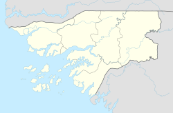
São Domingos (Guinea-Bissau)
| São Domingos | ||
|---|---|---|
|
|
||
| Coordinates | 12 ° 24 ′ N , 16 ° 12 ′ W | |
| Basic data | ||
| Country | Guinea-Bissau | |
| Norte | ||
| region | Cacheu | |
| ISO 3166-2 | GW-CA | |
| surface | 1,035.1 km² | |
| Residents | 29,116 (2009) | |
| density | 28.1 Ew. / km² | |
São Domingos is a small town in northwest Guinea-Bissau with 5102 inhabitants (as of 2009).
The place is the same seat management sector km² with an area of 1,035 and 29,116 inhabitants (2009), primarily the animist ethnic group Felupe belonging.
São Domingos is an important border town between Guinea-Bissau and its northern neighbor Senegal . The nearby city of Ziguinchor and the entire Casamance region have strong cultural ties with Guinea-Bissau. Guinea-Pissau Creole is spoken on both sides of the border , a Portuguese- based Creole language that goes back to the long Portuguese colonial history in the region.
Culture and sights
In São Domingos there is a market for handicrafts and everyday objects in the tradition of the local felupe people. At the slowly decaying port of the village you also have a good view of the vast mangroves and can photograph a perfectly shaped sunset here . In São Domingos, however, there are few buildings worth seeing.
The São Domingos sector is home to one of the most famous beaches in the country, Praia de Varela , which is increasingly suffering from the erosion caused by the sea tides . It is located near the eponymous village of Varela . Other white sandy beaches here are Praia dos Pescadores and the difficult-to-access Praia de Niquim .
economy

São Domingos is important as a trading center and most important town north of the regional capital Cacheu, also thanks to its location at the country's most important border crossing with Senegal.
A gentle, natural tourism is potentially promising here, especially in Varela an important step has been taken with the Italian-run Aparthotel Chez Hélène .
traffic
São Domingos is connected to the capital Bissau , 123 km to the south, via a comparatively good, paved road .
The small wooden jetty of São Domingos is left to decay, although it is used every day.
São Domingos has an airfield with the ICAO code GGSD.
structure
The São Domingos sector comprises a good 100 localities, mostly rural villages ( Tabancas ).
The sector capital São Domingos is divided into six, with subdivisions ten districts ( Bairros ). The most important locations in the sector also include:
- Barraca (four villages)
- Cassalol (three villages)
- Catão (four villages)
- Cubampor (a Balanta village with 240, a Felupe village with 72 and a Manjago village with 102 inhabitants)
- Djegue
- Ducujaque
- Edgim (three villages)
- Mato de Arame
- Susana
- Varela
An island also belongs to the sector:
- Ilha Djobel (223 inhabitants)
Web links
- Impressions from São Domingos , two-minute private video clip on YouTube , with music by the Guinea-Bissau singer M'Cissé
Individual evidence
- ↑ a b Inhabitants by region, sector and town by gender, 2009 census (p. 138, port.), PDF retrieval from the INE National Statistics Office of January 4, 2018
- ↑ Annual Statistical Report Guinea-Bissau 2015 (p. 10), PDF available from the National Statistics Office INE on January 4, 2018
- ↑ Joana Petrolho, Marta Rosa: À Descoberta da Guiné-Bissau . , Afectos com Letras / EU, Pombal 2015, ISBN 978-989-20-6252-5 , p. 61
- ↑ a b c Joana benzinho, Marta Rosa: À Descoberta da Guiné-Bissau. , Afectos com Letras / EU, Pombal 2015, ISBN 978-989-20-6252-5 , p. 67
- ↑ Joana Petrolho, Marta Rosa: À Descoberta da Guiné-Bissau. , Afectos com Letras / EU, Pombal 2015, ISBN 978-989-20-6252-5 , p. 68
- ↑ Inhabitants by region, sector and town by gender, 2009 census (p. 138ff), PDF access from the INE National Statistics Office of January 20, 2018

