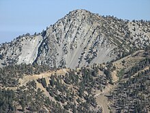
San Gabriel Mountains National Monument
The San Gabriel Mountains National Monument is an American national monument in the San Gabriel Mountains in Los Angeles County of California . This is on the northeastern outskirts of Los Angeles . It was designated by President Barack Obama by a Presidential Proclamation on October 10, 2014 with an area of 346,177 acres (140,093 hectares ). The National Monument was designated because of the presence of endangered animal and plant species, important historical sites and the risk of interference with the environment. Even before the designation as a National Monument , four parts of the area were designated as Wilderness Area Magic Mountain Wilderness , Pleasant View Ridge Wilderness , San Gabriel Wilderness and Sheep Mountain Wilderness . These protected areas remained unchanged even after the National Monument was designated .
Administration and land ownership of the National Monument
It is under the administration of the United States Forest Service (USFS). The entire area is federally owned and was looked after by the USFS in two national forests before it was designated . 342,177 acres belonged to the Angeles National Forest and 4002 acres belong to the San Bernardino National Forest . Previous uses may continue to be exercised unhindered. Millions of people come to the area for recreation. Over 15 million people live within a 90-minute drive of the National Monument. 70 percent of the open space around Los Angeles is in the reserve. 30 percent of Los Angeles' drinking water comes from the area.
Animal and plant species
In the sanctuary is Mount San Antonio at 3,069 meters, the highest peak in the San Gabriel Mountains, and the highest point in Los Angeles County. There are also numerous other high mountains. The forest area is covered with dense chaparral and oak forests, which become conifers with increasing height. Jeffrey pine (Pinus jeffreyi) , coastal pine (Pinus contorta) , Colorado fir (Abies concolor) and the common Douglas fir (Pseudotsuga menziesii) predominantly grow at high altitudes .
There are more than 300 endemic plant species in the area. Numerous species of birds, mammals, bats and insects can be found in the area. There are endangered species such as bighorn sheep , mountain yellow-legged frog ( Rana muscosa ) and the fish species Arroyo chub ( Gila orcuttii ). The endangered birds bald eagle , peregrine falcon , spotted owl , Song Sparrow and Bell's vireo ( Vireo bellii ) live here.
People in the area
Archaeological finds from Indian times up to 8000 years old have been found. More than 600 archaeological sites are known. Three of the sites are on the National Register of Historic Places . Ruins of old white settler huts and the Mount Lowe Railway are also in the area. At the San Gabriel River , the ghost town of Eldorado Ville is. Today, 87 miles of the Pacific Crest Trail and other major hiking trails are in the sanctuary. The Mount Wilson Observatory is here.
The expulsion from the San Gabriel Mountains National Monument was approved by polls among 80 percent of the electorate in Los Angeles County. Other expulsions from National Monument met with significantly less approval or were even rejected.
Web links
Individual evidence
- ↑ a b c d Presidential Proclamation - San Gabriel Mountains National Monument
- ↑ 2002 Estimates of Old Growth Forests. United States Department of Agriculture , accessed June 1, 2018 .
- ^ San Gabriel Mountains Forever: Los Angeles County Voters Ask President to Protect San Gabriels . August 18, 2014. Archived from the original on December 16, 2014.
Coordinates: 34 ° 15 ′ 0 ″ N , 117 ° 49 ′ 48 ″ W.


