Sant'Antioco (island)
| Sant'Antioco | ||
|---|---|---|
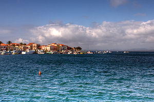
| Port of Sant'Antioco | ||
| Waters | Mediterranean Sea | |
| Archipelago | Sulcis Archipelago | |
| Geographical location | 39 ° 2 ′ N , 8 ° 24 ′ E | |
|
|
||
| length | 18.9 km | |
| width | 8.2 km | |
| surface | 109 km² | |
| Highest elevation | Perdas de Fogu 271 m slm |
|
| Residents | 14,160 (2016) 130 inhabitants / km² |
|
| main place | Sant'Antioco | |
| Menhirs Su Para e sa Mongia on Sant'Antioco | ||
Sant'Antioco is the second largest island in the Italian region of Sardinia . With an area of 109 km², it is also the fourth largest Italian island. It is located about 87 km from Cagliari and is connected to the island of Sardinia by a bridge. Sant'Antioco belongs to the province of Sud Sardegna , the most important places are Sant'Antioco , Calasetta and the tourist town of Maladroxia .
history
The island has been known to have been inhabited since the 5th millennium BC, as evidenced by remains of the Ozieri culture . Also Domus de Janas and menhirs testify to the Neolithic settlement. Nuraghi such as the Su Niu de Su Crobu ( crow's nest ) date from the Bronze Age .
Antiquity
The history of the island is directly linked to its most important and eponymous city of Sant'Antioco. The city was founded by the Phoenicians as Solki in the 8th century BC before it was founded in the 6th century BC. Became a Carthaginian colony. The Carthaginian rule over the island ended in the 2nd century BC. As a result of the Second Punic War . After the withdrawal of the Carthaginians, the victorious Romans built a connection to Sardinia . During the civil war between Julius Caesar and Pompey , the city sided with Pompey and was sacked after his defeat. In Roman times, today's Sant'Antioco was named Plumbaria , after the family name of the ruling family.
Middle Ages to modern times
The current name comes from St. Antiochus , a Christian missionary who died a martyr in 125 AD . After the decline and end of the Western Roman Empire , the city came under Byzantine control and was expanded into a fortress . At the beginning of the 8th century, the city was repeatedly attacked by the Saracens . The residents then left Sant'Antioco and withdrew to the hinterland. A new settlement with the Sardinian name Bidda was built inland around 935 with the help of the ruler of Cagliari , the so-called giudicato , but was forgotten after his death.
In the 14th century the island belonged to the Kingdom of Sardinia until it was added to the Archdiocese of Cagliari in 1503 . In 1758 there were 450 inhabitants on Sant'Antioco, most of whom lived in poor huts. In 1793 the island was occupied by French troops under Admiral Laurent Truguet , who imposed horrific taxes on the residents.
Attractions

On the island you can visit the giant tomb of Su Niu de su Crobu , a Phoenician tofet , several necropolises , the acropolis of Sant'Antioco and a Roman bridge. The city of Sant'Antioco also houses a Byssus Museum, the Ferruccio Barreca archaeological museum, the Su Pisu fortress built in 1812 and the 11th century Basilica of Sant'Antioco.


