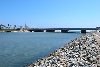
Santa Ana River
| Santa Ana River | ||
| Data | ||
| Water code | US : 273539 | |
| location | California (USA) | |
| River system | Santa Ana River | |
| source | in the San Bernardino Mountains | |
| muzzle | at Huntington Beach in the Pacific Coordinates: 33 ° 37 ′ 44 " N , 117 ° 57 ′ 29" W 33 ° 37 ′ 44 " N , 117 ° 57 ′ 29" W |
|
| Mouth height |
0 m
|
|
| length | 150 km | |
| Reservoirs flowed through | Seven Oaks | |
| Big cities | San Bernardino , Riverside , Anaheim , Santa Ana | |
The Santa Ana River is one of the largest rivers in Southern California . Its source is in the San Bernardino National Forest in San Bernardino County . From there it flows for about 150 kilometers to its confluence with the Pacific at Huntington Beach .
Due to the arid climate of the region, the river usually carries little water; Nevertheless, there is a considerable risk of flooding after rainfall. After flooding in 1862, 1938 and 1969, large parts of the river were canalized and dams and retention basins were built. The largest retention basin, Seven Oaks , was completed in 1999.
The names of the cities of Santa Ana and Anaheim on the lower reaches of the river are derived from the name Santa Ana River .
Web links
Commons : Santa Ana River - Collection of Images, Videos, and Audio Files

