Santa Isabel (island)
| Santa Isabel | |
|---|---|
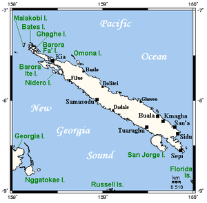
| Map of the island | |
| Waters | Pacific Ocean |
| Archipelago | Solomon Islands |
| Geographical location | 8 ° 0 ′ S , 159 ° 2 ′ E |
| length | 200 km |
| width | 22 km |
| surface | 2 999 km² |
| Highest elevation | Sasari 1220 m |
| Residents | 26,158 (2009) 8.7 inhabitants / km² |
| main place | Buala |
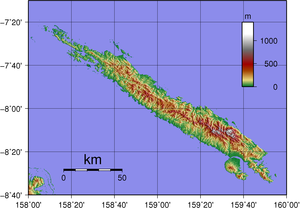
| Topographic map | |
Santa Isabel (formerly also Ysabel ) is an island in the Isabel province of the same name in the Pacific island state of the Solomon Islands . It lies between the islands of Choiseul and Malaita and borders the New Georgia Archipelago to the southwest .
The densely forested island is of volcanic origin and belongs to the island chain of the southern Solomon Islands . The elongated, almost 3000 km² island stretches from north to southeast over a length of 200 kilometers, but is on average only 22 kilometers wide.
The main town is Buala , located on the coast in the southeast of the island.
Santa Isabel, like the neighboring islands of the province and Choiseul, belonged to the German colonial empire in the Pacific from 1886 until the Samoa Treaty . In 1899 it went to Great Britain.
Individual evidence
- ↑ ON: Ysabel , in: Heinrich Schnee (Hrsg.): German Colonial Lexicon . Volume III, Quelle & Meyer, Leipzig 1920, p. 735.


