Santa Pau
| Santa Pau parish | ||
|---|---|---|
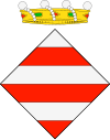
| coat of arms | Map of Spain | |

|
|
|
| Basic data | ||
| Autonomous Community : | Catalonia | |
| Province : | Girona | |
| Comarca : | Garrotxa | |
| Coordinates | 42 ° 9 ' N , 2 ° 34' E | |
| Height : | 496 msnm | |
| Area : | 49.04 km² | |
| Residents : | 1,565 (Jan 1, 2019) | |
| Population density : | 31.91 inhabitants / km² | |
| Municipality number ( INE ): | 17184 | |
| administration | ||
| Official language : | Castilian , Catalan | |
| Mayor : | Esther Badosa i Romañó | |
| Website : | webspobles.ddgi.cat/sites/santa_pau | |
Santa Pau is a medieval municipality with 1565 inhabitants (as of January 1, 2019) in the Garrotxa in Catalonia , Spain . It is located about ten kilometers south-east of Olot in the Garrotxa Volcanoes Nature Reserve . The municipality was qualified by the Catalan government as a place of particular historical and artistic interest, in particular because of the medieval arcades surrounding the market square ( Plaça major also Firal dels Bous , German: 'Ox market') and the St. Mary's Church from the 16th century .
Today's center, a triangular square lined with numerous arcades, emerged from the medieval ox market. The castle built in the 12th century took over the protective function for this business location.
The Santa Margarida volcano, just a few kilometers away, is a popular destination.
literature
- Ajuntament Santa Pau: Leaflet Santa Pau - Zona Volcànica de la Garrotxa, Conjunt històric-artístic Segle XII .
Web links
Individual evidence
- ↑ Cifras oficiales de población resultantes de la revisión del Padrón municipal a 1 de enero . Population statistics from the Instituto Nacional de Estadística (population update).

