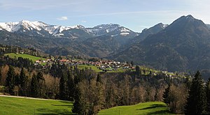
Sattelspitz (Bregenz Forest Mountains)
| Saddle point | ||
|---|---|---|
|
Panorama Dornbirner First to Hoher Staufen |
||
| height | 1562 m above sea level A. | |
| location | Vorarlberg , Austria | |
| Mountains | Freschengruppe , Bregenz Forest Mountains | |
| Dominance | 0.44 km → Alpkopf | |
| Notch height | 36 m ↓ ridge to the Alpkopf | |
| Coordinates | 47 ° 20 '16 " N , 9 ° 46' 12" E | |
|
|
||
| Normal way | from Ebnit on hiking trails or from Alpkopf on a narrow ridge | |
The Sattelspitz (also Sattelspitze ) is a 1562 meter high mountain in the Bregenz Forest Mountains , which is located in the municipality of Dornbirn ( Dornbirn district ) in the rear part of the Ebniter Valley near Ebnit . The top of the mountain is easily accessible on foot.
location
The Sattelspitz is about 2000 m as the crow flies northeast of the Salzbödenkopf ( 1765 m above sea level ). About 3500 m as the crow flies south-southeast is the Hohe Freschen and about 1000 m as the crow flies the Alpkopf .
There are several Alps around the Sattelspitz , of which the Sattelalpe (about 800 m as the crow flies at about 1165 m above sea level ) is the closest.
hike
The Spitzspitze requires surefootedness and good mountain boots. A narrow ridge leads from the Sattelspitz to the Alpkopf . When climbing the ridge between Alpkopf and Sattelspitz, you must have a head for heights. The closest hiking base is the Freschenhaus ( 1846 m above sea level ). The surrounding Alps are partly cultivated in summer.
literature
- Dieter Seibert : Bregenzerwald and Lechquellen Mountains. Alpine Club Guide alpine. 1st edition. Bergverlag Rother, Munich 2008, ISBN 978-3-7633-1095-1 , p. 82 ff .

