Schalesbach
| Schalesbach | ||
|
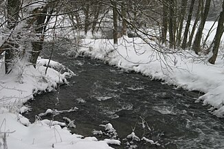
Schalesbach near Hunsrückhöhenstrasse in winter |
||
| Data | ||
| Water code | DE : 26762 | |
| location | Rhineland-Palatinate , Germany | |
| River system | Rhine | |
| Drain over | Dhron → Moselle → Rhine → North Sea | |
| source | In Morbach , northeast of the district of Hoxel 49 ° 47 ′ 5 ″ N , 7 ° 7 ′ 13 ″ E |
|
| Source height | approx. 564 m above sea level NN | |
| muzzle | North of Etgert in the Dhron coordinates: 49 ° 47 ′ 42 " N , 7 ° 1 ′ 14" E 49 ° 47 ′ 42 " N , 7 ° 1 ′ 14" E |
|
| Mouth height | approx. 259 m above sea level NN | |
| Height difference | approx. 305 m | |
| Bottom slope | approx. 35 ‰ | |
| length | 8.7 km | |
| Catchment area | 38.932 km² | |
The Schalesbach is a 8.72 km long orographic left tributary of the Dhron in the Hunsrück in Rhineland-Palatinate . In the upper reaches the brook is called Roerbach . The water catchment area has a size of 38.932 km², the river code number is 26762.
The Schalesbach rises in the municipality of Morbach at about 564 m above sea level. NN , northeast of the district Hoxel . It flows in a westerly direction, initially parallel to the Hunsrückhöhenstraße ( B 327 ), then forms the boundary between Morbach and Rorodt , Immert and Etgert and flows north of Etgert at around 259 m above sea level. NN in the Dhron.
Left tributaries are the Rielsbach (length 3.78 km), the Simm (length 5.91 km), the Rorodter Bach (length 2.74 km) and the Bornhellerbach (length 2.50 km).
Individual evidence
- ↑ a b Topographic map 1: 25,000
- ↑ a b Rhineland-Palatinate Water Management Authority
