Schegarka
|
Shegarka Chegarka |
||
|
|
||
| Data | ||
| Water code | RU : 13010200712115200013268 | |
| location | Novosibirsk Oblast , Tomsk Oblast ( Russia ) | |
| River system | If | |
| Drain over | Whether → Arctic Ocean | |
| source |
Wassjuganje 56 ° 1 '40 " N , 81 ° 47' 10" E |
|
| Source height | 148 m | |
| muzzle |
Whether coordinates: 57 ° 15 '25 " N , 84 ° 3' 50" E 57 ° 15 '25 " N , 84 ° 3' 50" E |
|
| Mouth height | 65 m | |
| Height difference | 83 m | |
| Bottom slope | 0.22 ‰ | |
| length | 382 km | |
| Catchment area | 12,000 km² | |
| Drainage location: 177 km above the mouth |
MNQ |
12.6 m³ / s |
| Right tributaries | Baksa | |
|
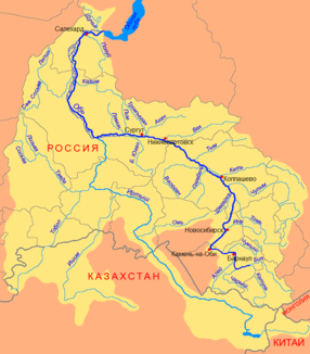
Course of the Schegarka (Шегарка) in the catchment area of the Ob |
||
The Schegarka ( Russian Шегарка ) is a left tributary of the Ob in the Oblasts of Novosibirsk and Tomsk in southern Western Siberia .
The Schegarka rises in the southeast of the Wassjuganje northwest of Novosibirsk . The Schegarka flows mainly in a northerly direction. The Schegarka flows into the Ob on the left after 382 km northwest of Tomsk . It drains an area of 12,000 km². It is mainly fed by the snowmelt . The river is ice-covered between November and April. 177 km above the mouth, the mean discharge (MQ) is 12.6 m³ / s. The most important tributary is the Baksa (Бакса) from the right.
Individual evidence
- ↑ Soviet General Staff Map 1: 200,000. Sheet O-44-XXIV. Edition 1987
- ↑ Soviet General Staff Map 1: 200,000. Sheet O-45-XXV. Edition 1970
- ↑ a b c d Article Schegarka in the Great Soviet Encyclopedia (BSE) , 3rd edition 1969–1978 (Russian)
- ↑ a b Schegarka in the State Water Register of the Russian Federation (Russian)
