
Schleifbach (Haslochbach)
|
Schleifbach (upper course: Springbach ) |
||
 The Schleifbach at the Zwieselmühle |
||
| Data | ||
| Water code | DE : 2471122 | |
| location |
Spessart
|
|
| River system | Rhine | |
| Drain over | Haslochbach → Main → Rhine → North Sea | |
| source | in the fountain 49 ° 51 ′ 21 ″ N , 9 ° 28 ′ 29 ″ E |
|
| Source height |
410 m above sea level NHN (Geißbrunnen) 325 m above sea level NN (fountain) |
|
| muzzle | at Zwieselmühle in Haslochbach Coordinates: 49 ° 50 '19 " N , 9 ° 28' 49" E 49 ° 50 '19 " N , 9 ° 28' 49" E |
|
| Mouth height | 225 m above sea level NHN | |
| Height difference | 185 m with periodic upper course 100 m from the fountain |
|
| Bottom slope | 34 ‰ | |
| length | 5.4 km with periodic upper reaches 3.4 km from the fountain |
|
| Catchment area | approx. 14.5 km² | |
 The Schleifbach (right) flows into the Haslochbach (left) |
||
The Schleifbach or Springbach is a left tributary of the Haslochbach in the Main-Spessart district in the Bavarian Spessart .
geography
course

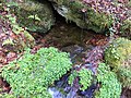
The source of the Schleifbach is actually located west of Bischbrunn . There it rises in the open field from the goat fountain (Lage) . After heavy rain or snowmelt , the stream emerges about 3 km further up the valley at Torhaus Aurora . The goat fountain was previously used as a drinking water fountain. At that time he was still lying in the forest. The Schleifbach flows through a biotope and is reinforced a little further south from the Breitenbrunnen (Lage) . It also served as a drinking water supply and pours more heavily than the goat well. The stream flows in a southerly direction and crosses under the federal highway 3 . However, the upper reaches of the Geiß and Breitenbrunnen are often dry. The stream bed then only carries water again from the fountain. There, larger amounts of spring water emerge in several places on the right side of the slope. From the fountain, the Schleifbach runs south-east to the Schleifmühle , enters the so-called Mühlental and bends in a south-westerly direction. It then flows past the Finstereck to the Zwieselmühle . The mill was also operated by the Haslochbach , into which the Schleifbach flows from the left.
Mills
Grinding mill

The grinding mill is the top mill in the Mühlental, consisting of four buildings. It was first mentioned in 1694 as the "Springmühle". A chapel has stood next to the mill since 1929. In 1941 the mill burned down completely, but was immediately rebuilt. The inn was opened in 1970.
Zwieselmühle
See Zwieselmühle .
Dark corner
The Finstereck (location) is a place of superstition . The inhabitants of the mill valley banished the ghosts, which were believed to haunt vacant buildings, in clay bottles that were buried on the Dark Corner. In 1909, a flood of the Schleifbach brook cleared these bottles. They were buried again that same night without opening a single one.
Picture gallery

Goat wells

Breitenbrunnen
Source of the fountain

Source of the fountain

.JPG)

