Schmutter (Geltnach)
| Schmutter | ||
|
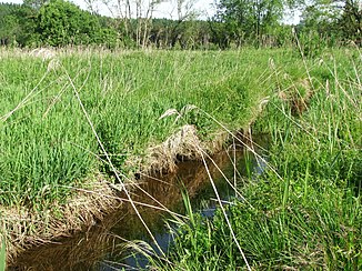
The Schmutter shortly before it flows into the Geltnach |
||
| Data | ||
| Water code | DE : 126522 | |
| location | Bavaria | |
| River system | Danube | |
| Drain over | Geltnach → Wertach → Lech → Danube → Black Sea | |
| source | on the Fahrenberg near Roßhaupten 47 ° 39 ′ 55 ″ N , 10 ° 42 ′ 6 ″ E |
|
| Source height | at 850 m above sea level NHN | |
| muzzle | near Stötten am Auerberg- Heggen in the Geltnach coordinates: 47 ° 42 ′ 45 " N , 10 ° 40 ′ 17" E 47 ° 42 ′ 45 " N , 10 ° 40 ′ 17" E |
|
| Mouth height | approx. 729 m above sea level NHN | |
| Height difference | approx. 121 m | |
| Bottom slope | approx. 15 ‰ | |
| length | 8.3 km | |
| Catchment area | 8.82 km² | |
| Left tributaries | only small inflows | |
| Right tributaries | Ochsenbrunnbach, Schönbichelbach, Schonrainbach, Ebersbach | |
| Communities | Roßhaupten , Stötten am Auerberg | |
The Schmutter is a 8.26 km long, south-south-east and right tributary of the Geltnach in the Wertach-Lech-Jungmoränenland . It flows in the Bavarian district of Ostallgäu .
Course and catchment area
The Schmutter runs entirely in the Wertach-Lech-Jungmoränenland, a part of the natural spatial main unit group Subalpines Jungmoränenland . The closely spaced sources of their uppermost source streams are located in the municipality of Roßhaupten a little west-northwest of the summit region of the Fahrenberg ( 867 m above sea level ) - a little below (right, longer source stream) and above (left, shorter source stream) at an altitude of 850 m .
The Schmutter flows in a predominantly north-northwest direction through unpopulated area. Almost 650 m after the union of its source streams, it receives a short tributary on the left and then runs through the Wasachmoos. Then four short streams flow into it - on the right-hand side: Ochsenbrunnbach in the municipality of Roßhaupten and, after changing to the municipality of Stötten am Auerberg , Schönbichel-, Schonrain- and Ebersbach after the change to the Schmutterhütte . After this the stream flows through the Hennengittermoos and the Rautenfilz.
The Schmutter then flows under a bridge ( 730 m ) of the connecting road that leads from Sulzschneid in the urban area of Marktoberdorf to Heggen in the municipality of Stötten am Auerberg, about 930 m west-southwest of Heggen in the Wertach tributary, Geltnach, coming from about south-southwest .
The catchment area of the Schmutter is 8.82 km² and thus a tiny bit larger than that of the Geltnach up to the confluence, which is a bit longer on this route.
Individual evidence
- ↑ a b c Map services of the Federal Agency for Nature Conservation ( information )
- ↑ a b c d Directory of brook and river areas in Bavaria - Lech river area, page 61 of the Bavarian State Office for the Environment, as of 2016 (PDF; 1.8 MB)
