Schneidheimer Sechta
| Schneidheimer Sechta | ||
|
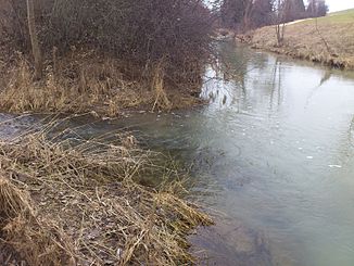
The Schneidheimer Sechta in Oberdorf am Ipf |
||
| Data | ||
| Water code | DE : 11882 | |
| location |
Southwest German step country
|
|
| River system | Danube | |
| Drain over | Eger → Wörnitz → Danube → Black Sea | |
| source | northwest of Tannhausen near Sederndorf 48 ° 59 ′ 25 ″ N , 10 ° 20 ′ 6 ″ E |
|
| Source height | approx. 526 m above sea level NHN | |
| muzzle | in Bopfingen from the left and north in the Eger coordinates: 48 ° 51 ′ 36 " N , 10 ° 21 ′ 15" E 48 ° 51 ′ 36 " N , 10 ° 21 ′ 15" E |
|
| Mouth height | 459.3 m above sea level NHN | |
| Height difference | approx. 66.7 m | |
| Bottom slope | approx. 3.1 ‰ | |
| length | 21.5 km | |
| Catchment area | 87.717 km² | |
|
The Schneidheimer Sechta (back) flows into the Eger (from left to front) |
||
The Schneidheimer Sechta is a left tributary of the Eger in the Ostalbkreis in Baden-Württemberg . It should not be confused with the Röhlinger Sechta , which is a nearby tributary of the Jagst .
course
The Schneidheimer Sechta rises northwest of Tannhausen , which it soon reaches in the southeast. It flows from there in a southerly direction through Oberschneidheim, Unterschneidheim and Oberdorf . In Bopfingen the Schneidheimer Sechta joins the Eger from the left, which is only 5.3 km long .
In the uppermost section to Tannhausen, the Sechta runs in a very shallow hollow, from Tannhausen in a valley that is not very deep. From Unterschneidheim it widens into a wide, flat hollow. It is only in the lowest section of the valley that its edge becomes steep for the first time, with the Ipf towering over its base by around 200 m , a witness mountain of the Swabian Alb that separates the Sechta from the noticeably lower foothills of the Alb around Lauchheim -Röttingen and Baldern Castle in its west.
There is hardly any forest anywhere on the banks of the Sechta. The Schneidheimer Sechta is often mistakenly viewed as the upper reaches of the Eger.
Tributaries
- Cone ditch (left)
- Viehlohgraben (left)
- Schlierbach (right)
- Salt ditch (left)
- Gansgraben / Riedbach (right)
- Hofwiesengraben (left)
- Westeregraben (right)
- Brühlgraben (right)
- Nordhausener Acht / Achbach (left)
- Aalbach (right)
- Kirchenbach (right)
- Blade moat (left)
- Edelbach (right)
- Quarry ditch (left)
- Unkentalgraben (left)
- Goldäckergraben (right)
Individual evidence
- ↑ a b c d State Institute for the Environment Baden-Württemberg (LUBW) ( information )
- ↑ Google Earth
Web links
- Course of the Schneidheimer Sechta on the BayernAtlas
- The Schneidheimer Sechta at OSM

