Seegraben (Schwarzbach)
| Seegraben | ||
|
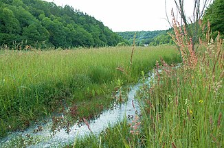
Inflow from the nature reserve Kapellenhalde - Wüster See in the German part of the Wangental |
||
| Data | ||
| Water code | CH : 2017, DE : 2198662 | |
| location |
Switzerland ( Canton Schaffhausen ); Germany ( Baden-Württemberg ) |
|
| River system | Rhine | |
| Drain over | Schwarzbach → Wutach → Rhine → North Sea | |
| confluence | from Ättigraben and Ettengraben between Osterfingen and Jestetten 47 ° 38 ′ 59 ″ N , 8 ° 32 ′ 4 ″ E |
|
| Source height | approx. 470 m above sea level M. | |
| muzzle | near Grießen , Klettgau in den Schwarzbach Coordinates: 47 ° 37 '53 " N , 8 ° 25' 46" E 47 ° 37 '53 " N , 8 ° 25' 46" E |
|
| Mouth height | 393 m | |
| Height difference | approx. 77 m | |
| Bottom slope | approx. 6.3 ‰ | |
| length | 12.2 km | |
| Catchment area | 26.979 km² | |
| Communities | Jestetten , Neunkirch , Wilchingen , Klettgau | |
The Seegraben is a 12 kilometer long right tributary of the Schwarzbach in the Swiss canton of Schaffhausen and in the German state of Baden-Württemberg . It flows through the Wangental and southern parts of the Waldshuts district, draining an area of around 27 square kilometers in the Klettgau .
course
The Seegraben is created at the confluence of the Ättigraben and Ettengraben at 470 m directly on the state border between the towns of Osterfingen and Jestetten . The Ättigraben rises at 605 m above sea level. M. in the municipality of Neunkirch , the Ettengraben at 538.5 m above sea level. NN in the municipality of Jestetten. The combined stream initially flows mainly in a north-westerly direction, takes up the outflow from the Wüster See area and now flows through the Wangental. Near Osterfingen, the brook makes an arc to the southwest and flows around the eastern and northern foothills of the Napberg . A little south of Wilchingen it crosses the border with Germany , which protrudes about 800 meters into Swiss territory. It crosses the municipality of Klettgau , touches the district of Weisweil and flows into the Schwarzbach from the right near Grießen after a 12-kilometer run (with Ettengraben ).
Tributaries
- Ölbach ( left )
- Hollow trench ( left )
- Stutzgraben / Stutzmühlengraben ( left )
- Wiesenbach ( right )
- Bachtobelbach ( left )
