Sharpsburg, Maryland
| Sharpsburg | ||
|---|---|---|
 Antietam National Battlefield near Sharpsburg |
||
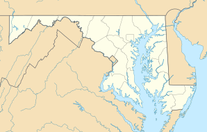
| Location of Sharpsburg, Maryland | ||
|
|
||
| Basic data | ||
| Foundation : | 1763 | |
| State : | United States | |
| State : | Maryland | |
| County : | Washington County | |
| Coordinates : | 39 ° 27 ′ N , 77 ° 45 ′ W | |
| Time zone : | Eastern ( UTC − 5 / −4 ) | |
| Residents : | 691 (as of: 2000) | |
| Population density : | 1,151.7 inhabitants per km 2 | |
| Area : | 0.6 km 2 (approx. 0 mi 2 ) of which 0.6 km 2 (approx. 0 mi 2 ) is land |
|
| Height : | 128 m | |
| Postal code : | 21782 | |
| Area code : | +1 301 | |
| FIPS : | 24-71600 | |
| GNIS ID : | 0587310 | |
| Website : | www.sharpsburg-md.com | |
Sharpsburg is a place in Washington County in the state of Maryland in the United States of America . The place is about 20 kilometers south of Hagerstown . 691 people live in Sharpsburg. During the Civil War , the Battle of Antietam took place in Sharpsburg in the vicinity of Antietam Creek , to which the Antietam National Battlefield commemorates today.
history
A settler named Joseph Chapline moved to the area around 1740 and founded the city in 1763 after the end of the French and Indian War. He named the place in honor of his friend and proprietary governor of the province of Maryland, Horatio Sharpe . Located on the east side of the Potomac River , the place had access to hydropower and became a preferred location for industry in the early 19th century. This was compounded when the Chesapeake and Ohio Canal was extended to Sharpsburg in 1836.
The Confederate General Robert E. Lee marched in late summer 1862 in Maryland and was the general of the Union George B. McClellan pursued. Their armies met on September 17, 1862 in the Battle of Antietam, also known as the Battle of Sharpsburg in the southern states . With around 3,600 dead and total casualties of around 23,000 men, the battle is considered the bloodiest day of the Civil War and US military history. The militarily inconclusive but strategically important victory of the Union allowed Abraham Lincoln to submit the Emancipation Proclamation . This victory was a turning point in the war because it slowed the Confederates' progress and prevented a victory on Union soil.
The site itself was added to the National Register of Historic Places as a Sharpsburg Historic District in 2008.
geography
According to the United States Census Bureau , the place covers an area of 0.6 square kilometers.
Demographics
According to the 2000 census, 691 people lived here in 286 households and 193 families. The population density was 1213 inhabitants per km². The racial the population was composed of 97.8 percent white, 0.4 percent African American and 0.6 percent Asian; 1.2 percent were descended from two or more races. Hispanic or Latino of any race was 0.3 percent of the population.
Of the 286 households, 26.6 percent had children under the age of 18 living with them, 54.2 percent of whom were married couples living together, 9.4 percent were single mothers and 32.5 percent were non-families. 26.2 percent consisted of single households and 8.0 percent had people 65 years of age or older. The average household size was 2.42, the average family size 2.90 people.
21.7 percent of the population were under 18 years old, 8.7 percent were 18 to 24 years old, 29.1 percent were 25 to 44 years, 27.6 percent were 45 to 64 years, and 12.9 percent were 65 or over more years old. The median age was 38 years. For every 100 females there were 103.2 males. For every 100 women aged 18 years or over, there were 101.9 men.
The median income for a household in the 41,786 US $ and the median income for a family was $ 52,875. Males had a median income of $ 37,500 and women $ 22,000. The per capita income was $ 20,917. 1.1% of the population and 3.1% of families are below the poverty line; these did not include children or young people under 18 years of age, but 5.6 percent of those 65 or older.
Web links
- Official website of Sharpsburg
- Maryland Municipal League: Sharpsburg
- War memorial in Sharpsburg "Sites of Memory"
Individual evidence
- ↑ US Census 2000
- ↑ WEEKLY LIST OF ACTIONS TAKEN ON PROPERTIES: 12/22/08 THROUGH 12/24/08 . In: National Register of Historic Places . National Park Service. March 2, 2009. Retrieved February 12, 2011.
- ^ Sharpsburg town, Maryland , data sheet with the results of the 2000 census at factfinder.census.gov .
