
Shelburne County
| Shelburne County | |
|---|---|
 Location of the region in Nova Scotia
|
|
| Basic data | |
| Country | Canada |
| province |
Nova Scotia
|
| Administrative headquarters | Shelburne |
| Coordinates : | 43 ° 46 ′ N , 65 ° 19 ′ W |
| Residents | 14,496 (as of 2011) |
| surface | 2,464.85 km² |
| Population density | 5.9 inhabitants / km² |
| Time zone : | Atlantic Standard Time ( UTC −4) Atlantic Daylight Time ( UTC −3, daylight saving time) |
| Web presence | www.municipalityofshelburne.ca |
Shelburne County is a county in the Canadian province of Nova Scotia .
It is located in the southwest of the province, its administrative seat is the city of the same name . Both are named after the British Prime Minister William Petty, 2nd Earl of Shelburne .
Population and breakdown
Shelburne County has a population of 14,496 (as of 2011).
The district consists of three cities and two so-called municipal districts .
| Parish | Residents |
|---|---|
| Barrington | 6994 |
| Shelburne | 4408 |
| city | Residents |
|---|---|
| Shelburne | 1686 |
| Clark's Harbor | 820 |
| Lockeport | 588 |

The Cox department store in Shelburne town
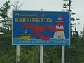
Barrington: Canada's lobster capital

Barrel factory in the town of Shelburne


Individual evidence
- ↑ a b The population figures refer to the year 2011 and come from the municipality profiles on the Statistics Canada website . Retrieved August 6, 2012.
Web links
Commons : Shelburne County, Nova Scotia - collection of pictures, videos, and audio files