Smalininkai (Jurbarkas)
| Smalininkai | ||
| State : |
|
|
| District : | Tauragė | |
| Rajong municipality : | Jurbarkas | |
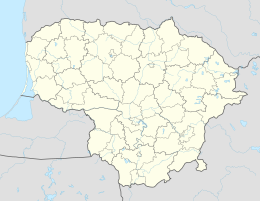
| Coordinates : | 55 ° 5 ' N , 22 ° 35' E | |
| Height : | 27 m | |
| Area (place) : | 1.77 km² | |
| Inhabitants (place) : | 485 (2016) | |
| Population density : | 274 inhabitants per km² | |
| Time zone : | EET (UTC + 2) | |
|
|
||
Smalininkai ( German Schmalleningken ) is a city ( Lithuanian Miestas ) and an adjacent village ( kaimas ) in the Tauragė district , Lithuania . Both belong to the Rajongemeinde Jurbarkas (Georgenburg) within the administrative district ( seniūnija ) Smalininkai.
Geographical location

The city and the village Smalininkai are situated 30 kilometers southeast of the county seat Tauragė (Tauroggen) and 44 kilometers northeast of the city of Sovetsk (Tilsit) , whose county area the then Schmalleningken belonged before 1945th Both places are on the KK 141 national road , which connects Kaunas (107 kilometers) via Jurbarkas ( Georgenburg , 14 km) with Pagėgiai ( Pogegen , 47 km) and Klaipėda ( Memel , 91 km). The national road KK 147 , which comes from Tauragė via Sakalinė, ends at Smalinikai .
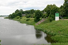
In the former district of Augstogallen of the city on the north bank of the Memel (Lithuanian Nemunas), today's border river to the Russian exclave and Kaliningrad Oblast ( Königsberg region (Prussia) ), the Swienta (Lithuanian Šventoji) , which has long been considered a border river, flows .
Place name
The Lithuanian place name Smalininkai indicates a tar or pitch burner ( smala = tar, pitch; smalius = tar burner, dealer). The pitch could have been obtained from pine resin in the nearby forest area Smalininkų miškas ( Schmalleningken Forest ) and used as sealing material u. a. have served for shipbuilding.
history
Smalininkai (village)
Today's village ( kaimas ) Smalininkai did not exist before 1945. It is located adjacent to the city limits, two kilometers north of the town of Smalininkai and west of the village of Antšvenčiai (Antschwenten) .
In 1925 1,741 people lived here. In 1987 the place had 1,069 inhabitants, in 2001 it was only 440 and 2011 only 326. Smalininkai village is one of eleven places within the Seniūnija (administrative district) Smalininkai, the center of which is the city of Smalininkai.
The village of Smalininkai is important because of its school of technology and business administration ( Smalininkų technologijų ir verslo mokykla ).
Smalininkai (city)
The area of the city ( miestas ) Smalininkai corresponds roughly to the area of the former Prussian rural community Schmalleningken . The place has been documented since the end of the 15th century. In 1792 he was granted market rights . At the beginning of the 19th century, the municipality consisted of five villages: Augstogallen (90 inhabitants), Endruszen (today Lithuanian: Endriušiai, 60 inhabitants), Schmalleningken (99 inhabitants), Schmalleningken-Zoll (12 inhabitants) and Wittkehmen (Vidkiemis, 89 inhabitants) .
Between 1874 and 1945 Schmalleningken was a two-fold administrative village: for the administrative district Schmalleningken-Dorf and the administrative district Schmalleningken-Forst. Both belonged to the Ragnit district until 1920 , then to the Pogegen district in the Memel region until 1939 and then to the Tilsit-Ragnit district .
In the 19th century, the Mikieten road (now Lithuanian: Mikytai) was built up to the state border at the Swienta . A winter harbor was built on the banks of the Memel between 1886 and 1888, which many ships used - even during floods and when the ice was falling - and which was later provided with a high dam. In 1902 the Pogegen – Schmalleningken small railway was put into service. It operated until 1944.
Before 1945, Schmalleningken was the seat of a chief forester's office, which managed some 1000 hectares of forest (Schmalleningken Forest).
In 1910 the community Schmalleningken had 1,972 inhabitants, the manor district Oberförsterei 139 inhabitants. The number decreased to 1,741 (municipality) and 112 (forest estate district) by 1925 and in 1939 still totaled 1,321.
In 1945 the Memel area and with it Schmalleningken became part of the Lithuanian Soviet Socialist Republic of the Soviet Union , and the village was renamed "Smalininkai". It is now a town in the Jurbarkas Rajong Municipality in the Tauragė District of the Republic of Lithuania, established in 1992 . The city is the center of an administrative district (Senūnija).
Schmalleningken-Dorf district (until 1945)
Seven places belonged to the administrative district Schmalleningken-Dorf:
| Surname | Lithuanian name |
|---|---|
| Antschwenten | Antšvenčiai |
| Noble Kassigkehmen | Kazikėnai |
| Schmalleningken-Augstogallen | Smalininkai |
| Schmalleningken-Endruszen (-Endruschen) | Endriušiai |
| Schmalleningken-Wittkehmen | Vidkiemis |
| Uszballen (Ußballen) | Užbaliai |
| Usztilten (Uschtilten) | Užtilčiai |
Schmalleningken-Forst district (until 1945)
Two localities were originally incorporated into the Schmalleningken-Forst district, but in the end there was only one:
| Surname | Lithuanian name | Remarks |
|---|---|---|
| Scrape off | Apšriūtai |
1937 reclassified to the district of Wischwill |
| Schmalleningken forest | Smalininkai |
Religions
Churches
Evangelical
Church building
The neo-Gothic brick parish church built in 1877/1878 was destroyed in the Second World War and the remains were removed. Today the parish hall, built in 1912 and used as a cinema during the Soviet era, serves as a place of worship.
Parish
In 1845 Schmalleningken Kirchdorf was to the parish several places of the church wiping Will were separated. In 1925 the parish, in which pastors have officiated continuously since 1845, had 2,200 parish members. At first it was part of the church district Ragnit, then the church district Pogegen in the Memel area (with its own consistory), and from 1939 in the church district Tilsit-Ragnit in the church province of East Prussia of the Church of the Old Prussian Union . Today's congregation belongs to the Evangelical Lutheran Church in Lithuania .
Of the two former Protestant cemeteries, one (near the train station) is still in use today. The inner-city cemetery has been preserved as a park.
Catholic
The parish church, which is still in use today, was built in 1935 and consecrated on July 28, 1935. Today it bears the name “Smalininkų Šv. Juozapo bažnyčia “(St. Joseph's Church). The parish belongs to the dean's office Šilutė (Heydekrug) in the Diocese of Telšiai (Telschen) of the Roman Catholic Church in Lithuania .
synagogue
A synagogue community existed in Schmalleningken until 1945 . The area of the former Jewish cemetery (in the former Augstogallen ) is still recognizable today.
school
Schmalleningken is a school location. The school building from the time before 1945 is still preserved today and was converted into a hotel and guest house in the 1990s. One of the prominent visitors to the school was the later politician Elisabeth Brönner .
Smalininkai District
Since 1995 the Smalininkų seniūnija, which belongs to the Rajongemeinde Jurbarkas . In addition to the city of Smalininkai, seven villages and three detached houses (lit. viensėdis) with a total of 1,286 inhabitants on an area of 22.3 km² are united in the administrative district (as of 2011). The district has been divided into the three subdistricts (lit. Seniūnaitija) Smalininkų kaimo seniūnaitija, Smalininkų miesto seniūnaitija and Vidkiemio seniūnaitija since 2009. The district includes:
| Place name | German name | status | Subdistrict |
|---|---|---|---|
| Antšvenčiai | Antschwenten | Village | Smalininkai land |
| Endriušiai | Endruszen / Endruschen | Village | Vidkiemis |
| Kazikėnai | Cash in | Village | Vidkiemis |
| Naudvaris | Neuhof | Single seat | Vidkiemis |
| Smalininkai (village) | Schmalleningken | Village | Smalininkai land |
| Smalininkai (city) | Schmalleningken | city | Smalininkai City and Smalininkai Country |
| Tetervinė | Wood grouse | Single seat | Vidkiemis |
| Užbaliai | Uszballen / Ußballen | Village | Vidkiemis |
| Užtilčiai | Usztilten / Uschtilten | Village | Vidkiemis |
| Vidkiemis | Wittkehmen | Village | Vidkiemis |
| Vilktakis | Wolf fun | Single seat | Vidkiemis |
people
- Curt Immisch (1865–1931), German businessman and politician (DDP)
- Skirmantas Mockevičius (* 1965), politician
- Jonas Matulevičius (* 1957), politician
Web links
Individual evidence
- ↑ Klaipėdos krašto surašymo duomenys 1925 m.
- ↑ a b Dietrich Lange: Geographical Register of Places East Prussia: Schmalleningken (2005)
- ↑ a b Smalininkai - Schmalleningken
- ↑ Schmalleningken
- ↑ a b Rolf Jehke, Schmalleningken-Dorf district
- ↑ a b Rolf Jehke, Schmalleningken-Forst district
- ^ Uli Schubert: Community directory, Ragnit district
- ^ Michael Rademacher: German administrative history from the unification of the empire in 1871 to the reunification in 1990. Pogegen district. (Online material for the dissertation, Osnabrück 2006).
- ↑ Historical photo of the Protestant parish church Schmalleningken
- ↑ Today's Evangelical Church in Smalininkai
- ↑ The chancel of today's church
- ↑ Former Schmalleningken school, now a hotel-pension, in 2010
- ↑ according to the 2011 census
- ↑ The Smalininkai City subdistrict includes Nemuno gatvė, Stoties gatvė, Kalninės gatvė, Kranto gatvė, Daržų gatvė, Liepų gatvė, Perkėlos gatvė, Gėlių gatvė and Tujų tako gatvė. The Aukštagalių gatvė, Parko gatvė and Beržų gatvė belong to the Smalininkai-Land subdistrict.


