Sokoto (river)
|
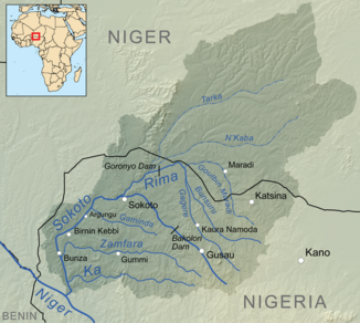
Sokoto Gublin Kebbi |
||
|
Sokoto catchment area |
||
| Data | ||
| location |
|
|
| River system | Niger | |
| Drain over | Niger → Atlantic Ocean | |
| source | south of Funtua in the state of Katsina 7 ° 6 ′ 0 ″ N , 11 ° 28 ′ 0 ″ E |
|
| Source height | 700 m | |
| muzzle | in Niger coordinates: 11 ° 24 ′ 11 " N , 4 ° 7 ′ 15" E 11 ° 24 ′ 11 " N , 4 ° 7 ′ 15" E |
|
| Mouth height | 150 m | |
| Height difference | 550 m | |
| Bottom slope | 0.92 ‰ | |
| length | over 600 km | |
| Catchment area | 193,000 km² (including 131,600 in Nigeria) | |
| Discharge A Eo : 193,000 km² at the mouth |
MNQ MQ Mq MHQ |
8 m³ / s 1162 m³ / s 6 l / (s km²) 5522 m³ / s |
| Left tributaries | Zamfara , Ka , Gaminda | |
| Right tributaries | Rima | |
| Reservoirs flowed through | Bakolori Dam | |
| Big cities | Gusau , Sokoto , Birnin Kebbi | |
| Medium-sized cities | Argungu | |
| Residents in the catchment area | over 15 million (in Nigeria) | |
|
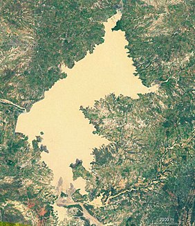
Satellite image of the Bakolori Reservoir |
||
The Sokoto (formerly known as Gublin Kebbi) is a tributary of the Niger in northwestern Nigeria .
course
The source of the Sokoto is located south of Funtua in the state of Katsina . In the direction of Sokoto in the state of Sokoto , it passes Gusau in the state of Zamfara . On the northern outskirts of Sokoto, after 320 kilometers, it joins the Rima River and continues towards Argungu and Birnin Kebbi in the state of Kebbi . About 120 kilometers after Birmin Kebbi the Sokoto flows into the Niger, which in turn flows into the Atlantic .
use
The Sokoto is important for the irrigation of the widely cultivated Sokoto valley as well as for the transport system.
Hydrometry
The flow rate of the river was measured in m³ / s at the mouth


