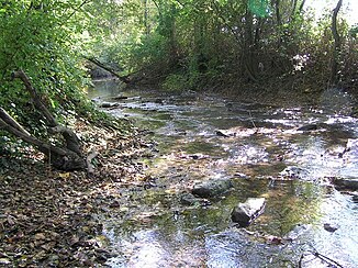
Soloire
|
Soloire in the upper reaches: Rouzille |
||
|
The river at Réparsac |
||
| Data | ||
| Water code | FR : R31-0400 | |
| location | France , Nouvelle-Aquitaine region | |
| River system | Charente | |
| Drain over | Charente → Atlantic Ocean | |
| source | in the municipality of Neuvicq-le-Château 45 ° 49 ′ 35 ″ N , 0 ° 10 ′ 15 ″ W |
|
| Source height | approx. 85 m | |
| muzzle | on the municipal boundary of Saint-Brice and Boutiers-Saint-Trojan in the Charente Coordinates: 45 ° 41 ′ 44 ″ N , 0 ° 17 ′ 52 ″ W 45 ° 41 ′ 44 ″ N , 0 ° 17 ′ 52 ″ W |
|
| Mouth height | approx. 7 m | |
| Height difference | approx. 78 m | |
| Bottom slope | approx. 2.2 ‰ | |
| length | 35 km | |
| Left tributaries | Tour advice | |
The Soloire is a river in France that runs in the Nouvelle-Aquitaine region . It rises under the name Rouzille in the municipality of Neuvicq-le-Château , first drains west to northwest, takes a hook to the southwest and then again to the southeast. The Sonnoire joins from the left just above Bréville and from this point on the river is finally called Soloire . It strives further south to southwest and after a total of 35 kilometers it flows into the Charente as a right tributary at the municipal boundary of Saint-Brice and Boutiers-Saint-Trojan , near the city of Cognac . On its way, the Soloire crosses the Charente-Maritime and Charente departments .
Places on the river
Attractions
The lower course of the river is part of a natural landscape that is worth preserving and is registered under Natura 2000 under code FR5402009.
