
Solar eclipse of August 11, 2018
| Solar eclipse of August 11, 2018 | |
|---|---|
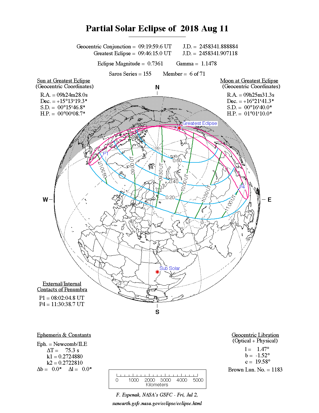
 Course of the penumbra on the earth's surface |
|
| classification | |
| Type | Partially |
| area | Northern Europe , Northeast Asia |
| Saros cycle | 155 (6 of 71) |
| Gamma value | +1.1478 |
| Greatest eclipse | |
| place | Arctic Ocean , southwest of Wrangel Island |
| location | 70 ° 24 ′ N , 174 ° 30 ′ E |
| time | August 11, 2018 09:46:15 UT |
| size | 0.7361 |

The solar eclipse of August 11, 2018 was a purely partial eclipse, so the earth was only hit by the penumbra of the moon.
Degree of coverage

The visibility area included the countries Greenland , Norway , Svalbard , Jan Mayen , Scotland , Faroe Islands , Sweden , Finland , Lithuania , Estonia , Iceland , Canada , Russia , China , Mongolia , Kyrgyzstan and Kazakhstan . The maximum phase was reached in Eastern Siberia . In Western Europe, the visibility limit was high in the north - Denmark and southern Sweden are already too far south. In northern Scandinavia and in the Moscow area only a low degree of coverage was achieved, as was the case in eastern China , where the eclipse took place during sunset.
Gallery
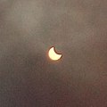
Balei , Russia
_(cropped).jpg)
.jpg)
.jpg)
Web links
|
Previous solar eclipses:
|
Later solar eclipses:
|
|||||||||
|
September 1, 2016 (circular) |
February 26, 2017 (ring-shaped) |
August 21, 2017 (total) |
February 15, 2018 (partial) |
July 13, 2018 (partial) |
August 11, 2018 (partial) |
January 6, 2019 (partial) |
July 2, 2019 (total) |
December 26, 2019 (circular) |
June 21, 2020 (circular) |
December 14, 2020 (total) |
|
|
|
|
|
|
|
|
|
|
|
|
| Lists: 20th century • 21st century • All lists | ||||||||||