
Solar eclipse of January 6, 2019
| Solar eclipse of January 6, 2019 | |
|---|---|
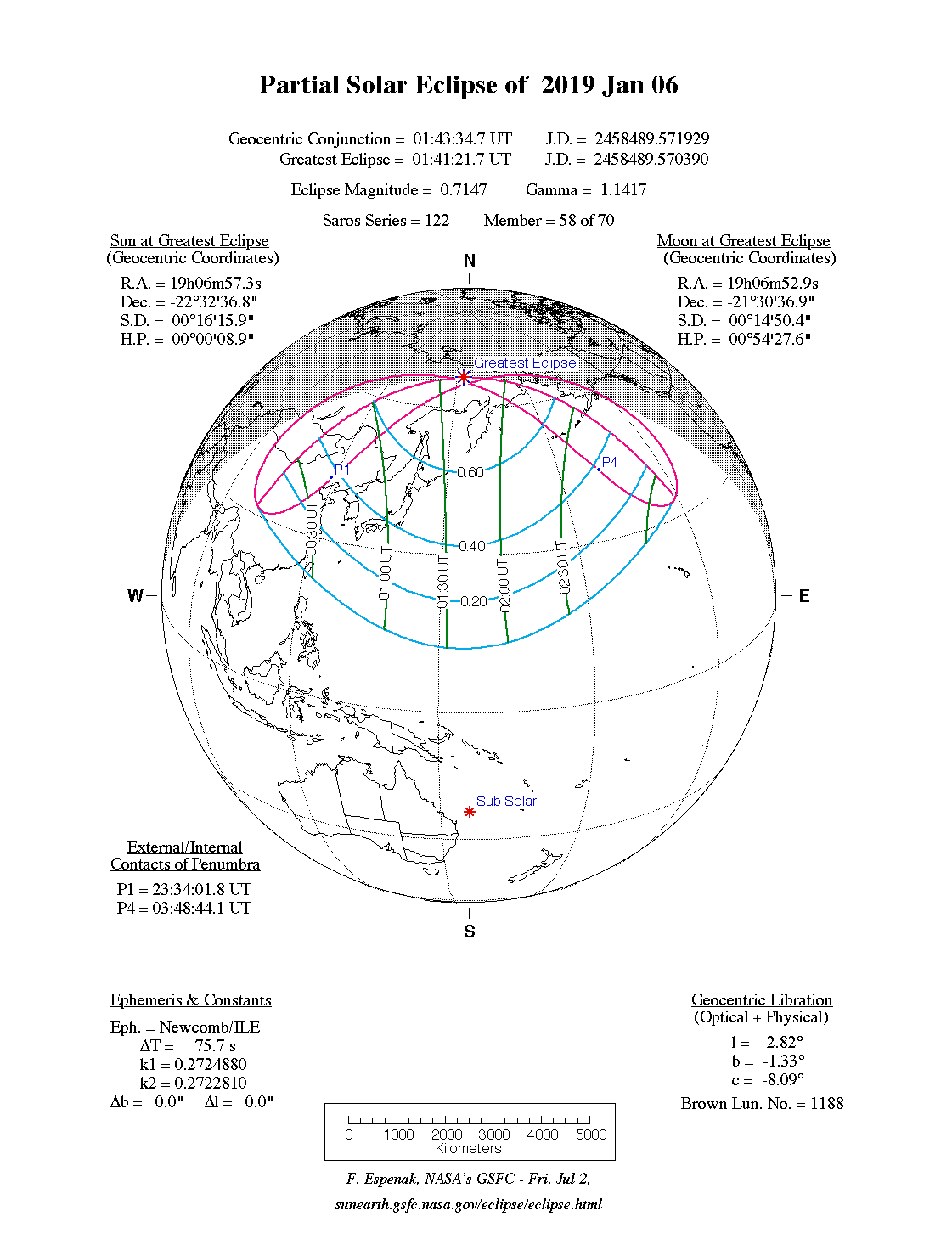
 Course of the penumbra on the earth's surface |
|
| classification | |
| Type | Partially |
| area | Northeast Asia , Northwest Pacific |
| Saros cycle | 122 (58 of 70) |
| Gamma value | +1.1417 |
| Greatest eclipse | |
| place | Northeast Siberia |
| location | 67 ° 24 ' N , 153 ° 36' E |
| time | January 6, 2019 1:41:22 UT |
| size | 0.7147 |

The solar eclipse of January 6th, 2019 was a purely partial eclipse, so the earth was only hit by the penumbra of the moon.
The visibility area included Northeast Asia and the Northwest Pacific. This solar eclipse could be observed particularly well in Japan , especially on the island of Hokkaidō and even better on the Russian island of Sakhalin . Seen from there, a relatively large part of the sun was covered by the moon , and the sun was not as close to the horizon in the sky as in eastern Siberia, where the maximum phase was reached north of the Kamchatka peninsula on the Arctic Circle .
The solar eclipse is the 58th eclipse of the 70 eclipses Saros cycle with the number 122. All subsequent eclipses of this cycle will also be only partial.
gallery


Web links
|
Previous solar eclipses:
|
Later solar eclipses:
|
|||||||||
|
February 26, 2017 (ring-shaped) |
August 21, 2017 (total) |
February 15, 2018 (partial) |
July 13, 2018 (partial) |
August 11, 2018 (partial) |
January 6, 2019 (partial) |
July 2, 2019 (total) |
December 26, 2019 (circular) |
June 21, 2020 (circular) |
December 14, 2020 (total) |
June 10, 2021 (circular) |
|
|
|
|
|
|
|
|
|
|
|
|
| Lists: 20th century • 21st century • All lists | ||||||||||