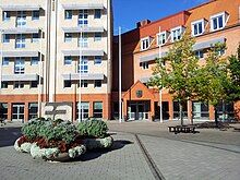
Staffanstorp (municipality)
| Staffanstorp municipality | |||||
|---|---|---|---|---|---|
|
|||||
| State : | Sweden | ||||
| Province (län): | Skåne County | ||||
| Historical Province (landskap): | Gentle | ||||
| Main place: | Staffanstorp | ||||
| SCB code: | 1230 | ||||
| Residents : | 25,396 (December 31, 2019) | ||||
| Area : | 107.3 km² (January 1, 2016) | ||||
| Population density : | 236.7 inhabitants / km² | ||||
| Website : | www.staffanstorp.se | ||||
| List of municipalities in Sweden | |||||
Coordinates: 55 ° 39 ' N , 13 ° 13' E
Staffanstorp is a municipality ( Swedish kommun ) in the southern Swedish province of Skåne län and the historic province of Skåne . The main town is Staffanstorp .
Attractions
The Iron Age settlement Uppåkra is located in the municipality .
places
The following five places are localities, ( tatorter ):
(in brackets the 2010 population)
- Bergströmshusen (209)
- Grevie Beden (241)
- Hjärup (4,265)
- Kyrkheddinge (276)
- Staffanstorp (14,808)
Town twinning
Staffanstorp municipality has seven twin cities:
Web links
Commons : Staffanstorp Municipality - Collection of images, videos and audio files
- Official website (Swedish, English)
Individual evidence
- ↑ Folkmängd i riket, län och kommuner December 31, 2019 at Statistiska centralbyrån
- ↑ Kommunarealer January 1, 2016 at Statistiska centralbyrån (including all inland waters)
- ↑ Staffanstorps kommun - Tatorter , accessed on May 9, 2018
- ↑ Staffantorp - Vänorter website , accessed on May 9, 2018


