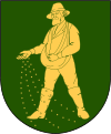
Svalöv (municipality)
| Svalöv municipality | |||||
|---|---|---|---|---|---|
|
|||||
| State : | Sweden | ||||
| Province (län): | Skåne County | ||||
| Historical Province (landskap): | Gentle | ||||
| Main place: | Svalov | ||||
| SCB code: | 1214 | ||||
| Residents : | 14,268 (December 31, 2019) | ||||
| Area : | 388.6 km² (January 1, 2016) | ||||
| Population density : | 36.7 inhabitants / km² | ||||
| Website : | www.svalov.se | ||||
| List of municipalities in Sweden | |||||
Coordinates: 55 ° 55 ' N , 13 ° 6' E
Svalöv is a municipality ( Swedish kommun ) in the southern Swedish province of Skåne län and the historic province of Skåne . The main town of the municipality is Svalöv .
geography
Svalöv is about 36 kilometers north of Malmö and about 30 kilometers southeast of Helsingborg (both as the crow flies). In the north, the municipality has a share in Söderåsen , a forested terminal moraine area that enjoys the status of a national park .
places
The following places are localities ( tatorter ):
| Locality | Residents * |
|---|---|
| Svalov | 3,833 |
| Teckomatorp | 1,651 |
| Kågeröd | 1,446 |
| Billeberga | 987 |
| Röstånga | 839 |
| Tågarp | 431 |
* December 31, 2010
economy
The municipality of Svalöv is largely agricultural .
Attractions
- Knutstorp Castle , a country castle
- Ring Knutstorp , a motorsport circuit near Kågeröd
Twin cities
There is a formal twinning with Kėdainiai in Lithuania. There are also agreements on cooperation with Łobez in Poland and Kyritz in Germany, and there is also cooperation with Kalundborg in Denmark .
Born in Svalöv
- Peter Eskilsson (1820–1872), genre painter from the Düsseldorf School, born in Billeberga
- Nils Christofer Dunér (1839–1914), astronomer, born in Billeberga
Web links
- Official website (Swedish)
Individual evidence
- ↑ Folkmängd i riket, län och kommuner December 31, 2019 at Statistiska centralbyrån
- ↑ Kommunarealer January 1, 2016 at Statistiska centralbyrån (including all inland waters)
- ^ Swedish Central Statistical Office , accessed on 23 August 2018
- ↑ Svalöv Municipality website , accessed on 23 August 2018


