Stožecké sedlo
| Stožecké sedlo | |||
|---|---|---|---|
|
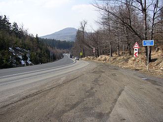
Schöbersattel, in the background the Tannenberg ( Jedlová ) |
|||
| Compass direction | north | south | |
| Pass height | 602 m | ||
| region | Ústecký kraj | Liberecký kraj | |
| Watershed | Lužnička → Mandau → Lausitzer Neisse → Oder | Boberský potok → Svitávka → Ploučnice → Elbe | |
| Valley locations | Dolní Podluží | Svor , Cvikov | |
| expansion | State road 9 | ||
| Mountains | Lusatian Mountains | ||
| map | |||
|
|
|||
| Coordinates | 50 ° 50 '23 " N , 14 ° 35' 45" E | ||
Stožecké sedlo (also Šébr , German Schöbersattel ), 602 m , is the most important pass in the Lusatian Mountains ( Lužické hory ) in the Czech Republic . It is located in the saddle between the mountains Pěnkavčí vrch ( Finkenkoppe ) and Stožec ( Schöber ). Today trunk road No. 9 crosses the Lusatian Mountains from Prague in the direction of Upper Lusatia at the Stožecké sedlo.
In 1805 the road was built over the pass to better connect the Bohemian Netherlands to the interior. The forerunner of this road connection was the Alte Prager Strasse , also Leipische Strasse , which, however , led past the Tollenstein further west . In the years 1981–83, the road at Stožecké sedlo was expanded to three lanes.
There is a parking lot directly at the pass, which serves as a starting point for hiking and ski tours in the Lusatian Mountains.

