Dolní Podluží
| Dolní Podluží | ||||
|---|---|---|---|---|
|
||||
| Basic data | ||||
| State : |
|
|||
| Region : | Ústecký kraj | |||
| District : | Děčín | |||
| Area : | 1517.5306 ha | |||
| Geographic location : | 50 ° 53 ' N , 14 ° 36' E | |||
| Height: | 370 m nm | |||
| Residents : | 1,202 (Jan 1, 2019) | |||
| Postal code : | 407 55 | |||
| License plate : | U | |||
| traffic | ||||
| Railway connection: | Rybniště – Varnsdorf | |||
| structure | ||||
| Status: | local community | |||
| Districts: | 3 | |||
| administration | ||||
| Mayor : | Iva Minárová (as of 2018) | |||
| Address: | Dolní Podluží 6 407 55 Dolní Podluží |
|||
| Municipality number: | 562432 | |||
| Website : | www.dolnipodluzi.cz | |||
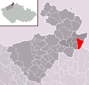
| Location of Dolní Podluží in the Děčín district | ||||

|
||||
Dolní Podluží (German Niedergrund ) is a municipality in the north of the Czech Republic in the Děčín district , Ústecký kraj .
geography
Geographical location
Dolní Podluží is an elongated village in the valley of the Lužnička ( Lausur ) stream at the northern foot of the Weberberg in the Lusatian Mountains , about one to four kilometers south and southwest of Varnsdorf . In the west it is connected with Horní Podluží ( Obergrund ), with which it forms a contiguous valley settlement about six kilometers long. In the east the place borders on the Free State of Saxony .
Community structure
The municipality Dolní Podluží consists of the districts Dolní Podluží ( Niedergrund ), Kateřina ( Katharinenthal ) and Světliny 2.díl ( Lichtenhain ). The basic settlement unit is Dolní Podluží.
Neighboring places
| Varnsdorf (Warnsdorf) | ||
| Horní Podluží (Obergrund), Jiřetín pod Jedlovou (Sankt Georgenthal) |

|
Großschönau |
| Mařenice (Großmergthal) |
history
Niedergrund formed a community in the Warnsdorf judicial district from the middle of the 19th century . The Kreuzkantor Jacob Beutel was born in Niedergrund in 1624 .
Web links
- Web links from Dolní Podluží
- Historical pictures of Dolní Podluží
- Official website of Dolní Podluží Czech
- Other websites from Dolní Podluží
Individual evidence
- ↑ http://www.uir.cz/obec/562432/Dolni-Podluzi
- ↑ Český statistický úřad - The population of the Czech municipalities as of January 1, 2019 (PDF; 7.4 MiB)
- ↑ http://www.uir.cz/casti-obce-obec/562432/Obec-Dolni-Podluzi
- ↑ http://www.uir.cz/zsj/02997/Dolni-Podluzi


