Weberberg (Lusatian Mountains)
| Weberberg | ||
|---|---|---|
|
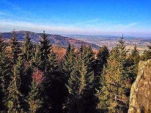
View from Lausche to Weberberg, Warnsdorf in the background on the right |
||
| height | 711 m nm | |
| location | Czech Republic | |
| Mountains | Lusatian Mountains | |
| Dominance | 2 km → Pěnkavčí vrch | |
| Coordinates | 50 ° 51 '53 " N , 14 ° 37' 5" E | |
|
|
||
| rock | Phonolite | |
The Weberberg , or Vyhlídka in Czech , formerly Waltersdorfer Buchberg , is the ninth highest mountain of the Lusatian Mountains in the Czech Republic with 711 m nm . Its summit is about 60 m west of the German-Czech border in the Niedergrund district .
location
Hörndel / Rohál
The Weberberg is the main summit of the distinctive Hörndel phonolite ridge ( Rohál in Czech ), incorrectly referred to on older maps as the goat's back , which rises south of Niedergrund above the Lausur valley . To the south and west, the Hörndel falls to the Kohlhautal ( Údolí Milířky in Czech ), an old mining area, through which the Kohlhaubach ( Milířka in Czech ) flows. To the west, two unnamed secondary peaks ( 652 m and 643 m ) adjoin the Weberberg on the Hörndel . The entire Hörndel ridge is covered with a high beech forest, only a few clearings offer a view of the Lausur valley.
Surroundings
To the east of Weberberg are the foothills of the Sängerhöhe and Unglückstein 497 m and the Ottoberg 520 m . In the southeast the Lausche rises 793 m , south the Finkenkoppe 792 m in the west the Tannenberg 774 m .
The mountain is surrounded in the north by Niedergrund, in the northeast by Herrenwalde and Pilzdörfel , in the east by Waltersdorf and Neu Sorge , in the southeast by Jägerdörfel and Ober Lichtenwalde . in the west of Innozenzidorf and in the north-west of St. Georgenthal .
description
Because of the high beech forest, the Weberberg hardly offers a view. On the northern slope there used to be a remnant of a mixed primeval forest with mighty shingle beeches , which in the 1960s formed the Richters Urwald nature reserve ( Richterův prales in Czech ). The Kohlflössel and the Pfarrbach arise on the eastern slope of the mountain , south of the Kohlhaubach. On the Saxon side, the Oberlausitzer Bergweg runs below the summit .
particularities
Black Gate / Černá brána
A pass path used to lead from the Kohlhaugrund through the Eisgasse to Waltersdorf via the Schwarzes Tor saddle south of the Weberberg.
Dreiecker / Trojhran
The sandstone rock Dreiecker (Czech Trojhran ) 673 m , located south of the Weberberg at the Schwarzen Tor directly on the German-Czech border at Vogelherd (Czech Ptačinec ), is a historical border point. He previously formed the triangle between the dominions Rumburg (R), Reich city (RE) and the common image of the city Zittau (Z). In addition to a granite modern boundary stone attached to the rock, old boundary signs and several dates from the period from 1653 to 1783 are carved into the rock. Today the German-Czech border at Dreiecker turns from north to east and meets there with the borders of the Bohemian districts of Böhmisch Leipa and Tetschen .
literature
- The south-eastern Upper Lusatia with Zittau and the Zittau Mountains (= values of the German homeland . Volume 16). 1st edition. Akademie Verlag, Berlin 1970, pp. 198-199.

