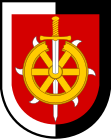
Merboltice
| Merboltice | ||||
|---|---|---|---|---|
|
||||
| Basic data | ||||
| State : |
|
|||
| Region : | Ústecký kraj | |||
| District : | Děčín | |||
| Area : | 825.053 hectares | |||
| Geographic location : | 50 ° 41 ' N , 14 ° 21' E | |||
| Height: | 400 m nm | |||
| Residents : | 206 (Jan. 1, 2019) | |||
| Postal code : | 405 02 | |||
| License plate : | U | |||
| traffic | ||||
| Street: | Starý Šachov - Verneřice | |||
| structure | ||||
| Status: | local community | |||
| Districts: | 1 | |||
| administration | ||||
| Mayor : | Lukáš Tomeška (as of 2018) | |||
| Address: | Merboltice 53 405 02 Děčín 2 |
|||
| Municipality number: | 545791 | |||
| Website : | www.merboltice.cz | |||
| Location of Merboltice in the Děčín district | ||||

|
||||
Merboltice (German Mertendorf ) is a municipality in the Czech Republic . It is located 13 kilometers southeast of Děčín and belongs to the Okres Děčín .
geography
Geographical location
The Waldhufendorf extends in the north of the Bohemian Central Uplands for four kilometers along the Merboltický creek ( Triebschbach ). To the north rises the Kamenec ( Steinberg , 519 m), in the northeast of the Merboltický Kopec (426 m) and Kozí vrch (428 m), south of the Strážný vrch ( Hutberg , 601 m) and in the southwest of the Zaječí vrch (556 m).
Community structure
No districts are shown for the municipality of Merboltice.
Neighboring communities
Neighboring towns are Brlohy, Starý Šachov and Malý Šachov in the north, Dolní Police, Malá Strana, Žandov and Zpěvné in the northeast, Podlesí, Novosedlo and Valteřice in the east, Heřmanice in the southeast, Velká Javorská, Malá Javorská and Louíčky in the south, Vernebramice , Sluková in the southwest and Valkeřice in the west.
history
The first mention of the parish Merbotonis villa was in 1352 in the papal tithe registers . The village was subject to the rule of Scharfenstein . In 1530 Mertendorf became a Protestant parish after the Reformation . In the course of the re-catholicization, the parish went out in 1624 and the village was parish off to Algersdorf . The berní rula from 1654 shows 20 farmers, seven bidders and two gardeners for Mertendorf. The place was the seat of a vomit. Between 1708 and 1709 the new church of St. Catherine. In 1713 the village consisted of 113 houses. During the Potato War in 1778 the Prussian Army retreated from Bohemia for six days through Mertendorf and destroyed its provisions and ammunition wagons. In 1787 a branch of the Algersdorf Church was set up in Mertendorf. In 1833, 948 people lived in the 179 houses of Mertendorf. These lived primarily from agriculture and forestry. In addition, musical instruments were made, the most famous instrument maker was Stephan Storch.
After the abolition of patrimonial Mertendorf / Merboltice formed with the district Klein Schokau / Malý Šachov from 1850 a political municipality in the district administration Tetschen / Děčín. In 1857 1085 people lived in the place. In 1888, Klein Schokau broke away and formed its own community. In 1890 the community of Mertendorf had 985 inhabitants, in 1930 there were 864. After the Munich Agreement , the community was added to the German Reich in 1938 and belonged to the Tetschen district until 1945 , and from 1943 Tetschen-Bodenbach . In 1939 817 people lived in Mertendorf, almost all of whom belonged to the German ethnic group. In 1945 Merboltice returned to Czechoslovakia and the German residents were expelled . The baroque church fell into disrepair after the Second World War. In 1975, in an act of communist cultural barbarism, the Church of St. Catherine, as well as the Barbarakirche in neighboring Valkeřice , demolished and the cemetery destroyed. Between 1980 and 1990 Merboltice was a district of Verneřice . In 1999 Merboltice received a municipal coat of arms and a banner. Merboltice has been a village monument zone since 2005. In May 2009, preparations began to build a new church.
Culture and sights
- Bell tower in the former cemetery
- timbered Bohemian log houses, the oldest from 1780
- Strážný vrch mountain with an observation tower, south of the village
- Kamenná hůra nature reserve with the Eisborn spring on the Kamenec mountain, north of the village

