Labská Stráň
| Labská Stráň | ||||
|---|---|---|---|---|
|
||||
| Basic data | ||||
| State : |
|
|||
| Region : | Ústecký kraj | |||
| District : | Děčín | |||
| Area : | 288.3216 ha | |||
| Geographic location : | 50 ° 51 ' N , 14 ° 14' E | |||
| Height: | 339 m nm | |||
| Residents : | 219 (Jan 1, 2019) | |||
| Postal code : | 407 14 | |||
| License plate : | U | |||
| traffic | ||||
| Street: | Arnoltice - Labská Stráň | |||
| structure | ||||
| Status: | local community | |||
| Districts: | 1 | |||
| administration | ||||
| Mayor : | Ing. Bc. Ludmila Hejdová (as of 2018) | |||
| Address: | Labská Stráň 111 407 14 Labská Stráň |
|||
| Municipality number: | 544701 | |||
| Website : | sweb.cz/labskastran | |||
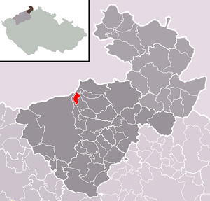
| Location of Labská Stráň in the Děčín district | ||||

|
||||
Labská Stráň (German Elbleiten ) is a municipality in the Czech Republic . It is located seven kilometers north of the city center of Děčín in Bohemian Switzerland and belongs to the Okres Děčín .
geography
Geographical location
Labská Stráň is located on the right side above the Elbe valley on the Binsdorf plateau (Zappenland), which is cut through to the north by the Suchá Kamenice gorge ( Dürrkammnitz ).
Neighboring places
Neighboring towns are Hřensko in the north, Janov in the northeast, Růžová in the east, Arnoltice and Bynovec in the southeast, Podskalí in the south and on the other side of the Elbe Dolní Žleb in the west.
| Hřensko (Herrnskretschen) | ||
| Hřensko (Herrnskretschen) |

|
Růžová (Rose Village) |
| Ludvíkovice (Loosdorf) | Arnoltice (Arnsdorf) |
history
The village was created around 1400 on a cleared area in the forests of the Elbe Sandstone Mountains. The place belonging to the Scharfenstein lordship was first mentioned in a document in 1467 as Hinteres Neudorf . Until the 17th century it was called Neudorf and it was not until the 18th century that the designation Elbleuten or Elbleiten gradually became established. Its inhabitants lived from agriculture and forestry.
During the reign of the von Salhausen family , property was divided and Elble people came to the new rule of Binsdorf . In 1612 the Kaunitz acquired the property and in 1614 the Counts Kinsky followed . After the murder of Wilhelm Graf Kinsky on the night of the murder of Eger , his property was confiscated in 1634.
The imperial field marshal Johann von Aldringen and his successors, the Count Clary-Aldringen , held it until the patrimonial rule was replaced in 1848.
Between 1701 and 1711, Franz Karl von Clary-Aldringen had a viewing terrace with an artificial grotto built over the Elbe valley, to which a dead straight avenue from Binsdorf Castle led from the southeast. This vantage point, known as the Belvedere , is 158 m above the Elbe and is considered the oldest in Bohemian Switzerland . From then on, theatrical performances and other festivities for the count's guests were held at the Belvedere.
After the fire at Binsdorf Castle in 1790, the Clary-Aldringen moved their headquarters to the up-and-coming Töplitz spa . Folk festivals were held at the Belvedere and after the Palm Sunday procession the smrtka was ceremoniously thrown into the Elbe valley.
In 1833 Elbleiten consisted of 59 houses and had 435 inhabitants. In 1839 the Belvedere was redesigned and given a second entrance. Instead of the theater mask on the arcade to the grotto, the Elbleiten stonemason Johann Hegenbarth made a coat of arms stone for Count Clary-Aldringen. In 1841 a wooden inn was built at the Belvedere, which existed until 1857. Between 1888 and 1889, a permanent inn with accommodation was built at the Belvedere. The builder was Eduard Hegenbarth from Elbleiten, a brother of the painter Josef Hegenbarth .
Culture and sights
- Lookout Belvedér with guest house
Individual evidence
- ↑ http://www.uir.cz/obec/544701/Labska-Stran
- ↑ Český statistický úřad - The population of the Czech municipalities as of January 1, 2019 (PDF; 7.4 MiB)

